
Vehicle registration GR Elevation 603 m Population 2,149 (1 Apr 2009) Local time Tuesday 7:01 PM | Time zone CET (UTC+1) Website www.st-agatha.at Area 31.8 km² Postal code 4084 Area code 07277 | |
 | ||
Weather 11°C, Wind SW at 3 km/h, 71% Humidity | ||
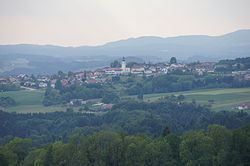
Sankt Agatha is a municipality in the district of Grieskirchen in the Austrian state of Upper Austria.
Contents
Map of Sankt Agatha, Austria
Geography
Sankt Agatha lies in the Hausruckviertel. About 30 percent of the municipality is forest, and 65 percent is farmland.
References
Sankt Agatha Wikipedia(Text) CC BY-SA