
Population 437 (2011) Sovereign state United Kingdom | OS grid reference TF695285 Area 41.91 km² | |
 | ||
Weather 9°C, Wind W at 39 km/h, 53% Humidity Points of interest Sandringham House, Sandringham Country Park, Dersingham Bog, York Cottage, The Royal Station | ||
Sandringham norfolk
Sandringham is a village and civil parish in the north of the English county of Norfolk. The village is situated 2 kilometres (1.2 mi) south of Dersingham, 12 km (7.5 mi) north of King's Lynn and 60 km (37 mi) north-west of Norwich.
Contents
Map of Sandringham, UK
The civil parish extends westwards from Sandringham village to the shore of the Wash some 6 km (3.7 mi) distant, and includes the villages of West Newton and Wolferton. It has an area of 41.91 km2 (16.18 sq mi) and in 2001 had a population of 402 in 176 households. The population had increased to 437 at the 2011 Census. For the purposes of local government, the parish is in the district of King's Lynn and West Norfolk.
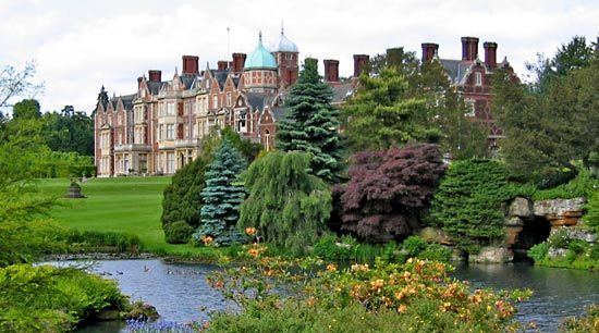
Sandringham is best known as the location of Sandringham House and its estate, a favoured holiday home of Queen Elizabeth II and several of her predecessors. Near to Sandringham house is the Royal Stud, a stud farm that houses many of the royal horses. The village was the birthplace of Diana, Princess of Wales.