
Website www.co.san-saba.tx.us Founded 1856 | Largest town San Saba Area 2,947 km² Population 6,012 (2013) | |
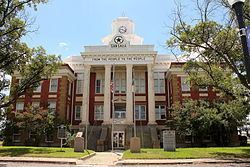 | ||
Points of interest Wedding Oak Winery, Mill Pond Park - San Saba - TX, John H "Shorty" Brown Ce | ||
Search for lost san saba gold mine san saba county texas 1966
San Saba County is a county located on the Edwards Plateau in western Central Texas. As of the 2010 census, its population was 6,131. Its county seat is San Saba. The county is named after the San Saba River, which flows through the county.
Contents
- Search for lost san saba gold mine san saba county texas 1966
- Map of San Saba County TX USA
- Historical marker dedication harmony ridge cemetery san saba county texas 6 9 2013
- History
- Timeline
- Geography
- Major highways
- Adjacent counties
- Demographics
- Attractions
- Towns
- Unincorporated Communities
- Notable people
- References
Map of San Saba County, TX, USA
Historical marker dedication harmony ridge cemetery san saba county texas 6 9 2013
History
United Confederate Veterans organized a chapter known as the "William P. Rogers Camp" in San Saba County after the death in 1889 of Confederate President Jefferson Davis. Rogers, a hero of the Battle of Corinth in Mississippi, was a native of Georgia. He did not live in San Saba, but his daughter, Fannie, married one of Rogers' officers, George Harris, who moved there in 1880. A former county judge, Harris served as a commander of Rogers Camp, named for his father-in-law. The veterans' organization lasted until the early 1930s.
During the 1880s, a vigilante mob, organized like a fraternal lodge, killed a number of San Saba County settlers. In 1896, the Texas Rangers began an investigation. Uluth M. Sanderson, editor of the San Saba County News, ran editorials against the mob. Ultimately, the mob was broken by the Ranger Captain Bill McDonald and District Attorney W.C. Linder. Many of the mob executions committed throughout Texas in the time following the Civil War were racially motivated and often committed by members of the Ku Klux Klan (KKK), which formed in Shelby County, Texas. Most of the people killed by vigilante mobs in the five years after the war were "suspected slave rebels and white abolitionists". Although the KKK in Texas was less active by the 1870s, lives continued to be taken each year. In 1885, for the state of Texas, "...an estimated twenty-two mobs lynched forty-three people, including nineteen blacks and twenty-four whites, one of whom was female". "The San Saba County lynchers, the deadliest of the lot, claimed some twenty-five victims between 1880 and 1896. Vigilante lynching died out in the 1890s, but other varieties of mobs continued."
Timeline
Geography
According to the U.S. Census Bureau, the county has a total area of 1,138 square miles (2,950 km2), of which 1,135 square miles (2,940 km2) is land and 3.1 square miles (8.0 km2) (0.3%) is water.
Major highways
Adjacent counties
Demographics
As of the census of 2010, 6,131 people, 2,289 households, and 1,616 families resided in the county. The population density was 6 people per square mile (2/km²). There were 2,951 housing units at an average density of 3 per square mile (1/km²). The racial makeup of the county was 84.50% White, 2.73% Black or African American, 1.07% Native American, 0.11% Asian, 10.52% from other races, and 1.07% from two or more races. About 21.6% of the population were Hispanic or Latino of any race.
Of 2,289 households, 29.10% had children under the age of 18 living with them, 58.90% were married couples living together, 8.40% had a female householder with no husband present, and 29.40% were not families. About 27.5% of all households were made up of individuals and 15.90% had someone living alone who was 65 years of age or older. The average household size was 2.45 and the average family size was 2.97.
In the county, the population was distributed as 27.90% under the age of 18, 8.20% from 18 to 24, 20.80% from 25 to 44, 22.80% from 45 to 64, and 20.30% who were 65 years of age or older. The median age was 39 years. For every 100 females, there were 107.40 males. For every 100 females age 18 and over, there were 97.10 males.
The median income for a household in the county was $30,104, and for a family was $35,255. Males had a median income of $25,334 versus $20,111 for females. The per capita income for the county was $15,309. About 13.30% of families and 16.60% of the population were below the poverty line, including 24.50% of those under age 18 and 11.60% of those age 65 or over.
Attractions
San Saba County is home to the only suspension bridge open to traffic in the State; the Regency Bridge spanning the Colorado River, located off FM 500 in the northern part of the county, was built in 1939.
The Beveridge Bridge, built in 1896 spanning the San Saba River, was the only other suspension bridge in Texas open to traffic until 2004, when it was replaced by a concrete bridge. The Beveridge Bridge, since restored and open as a pedestrian bridge, is located on the northwest edge of the city of San Saba, on China Creek Road, just north of the Wedding Oak.
San Saba County has produced more Texas 6-Man Football State Championships than any other county in the State of Texas. The towns of Richland Springs (Richland Springs Coyotes) and Cherokee (Cherokee Indians) have won a total of 9 State Championships. Richland Springs has appeared in a total of 7 State Championship games and have won 6 of them (2004, 2006, 2007, 2010, 2011, 2012). Cherokee has appeared in a total of 4 State Championship games and have won 3 of them (1973,1975,1978). San Saba County is considered the Capital of "Texas Six-Man Football".
Towns
Unincorporated Communities
Notable people
Actor Tommy Lee Jones was born in San Saba and owns a ranch outside of town.