
District Lone district Barangays Area 140.5 km² Area code 42 | Founded 1631 Time zone PST (UTC+8) Dialling code 42 | |
 | ||
Neighborhoods Bachawan, Lusong, Doña Juana | ||
San Agustin (formerly Guintigui-an and Badajoz) is a fourth class municipality in the province of Romblon, Philippines.
Contents
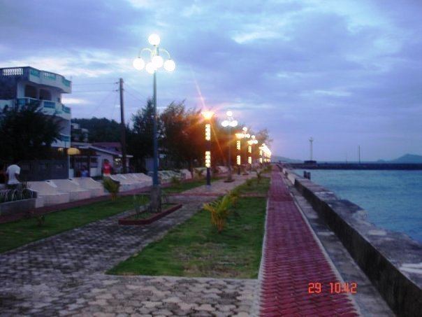
- Map of San Agustin Romblon Philippines
- Romblon youth camp san agustin romblon 2009 part 1
- History
- Former names and territorial changes
- Geography
- Barangays
- Demographics
- Local government
- Education
- Health
- Economy
- Transportation
- Communications
- Tourism
- References
Map of San Agustin, Romblon, Philippines
Romblon youth camp san agustin romblon 2009 part 1
History
San Agustin was known during Spanish times as Guintigui-an because of the abundance of a fish called "tigue" in the area. Negrito and Mangyan tribes from Panay and Mindoro were the first inhabitants, as well as migrants from island of Romblon, and southern Tablas.
In the early part of Spanish conquest, the first settlement was at barangay Cabolutan. The early settlers found it very trying at times to cross the channel to Romblon town to attend to civil and religious duties. To solve this problem, Cabolutan leaders discussed the matter such as building a visita in their settlement of around 250 souls. Finally in 1635, the first church building made of coral stone and lime was started.
In 1700, Spanish authorities decided to separate Cabolutan in Tablas Island from Romblon, with its seat at visita Cabolutan subjugating all settlements west of Tablas Island. The new pueblo or town of Cabolutan progressed slowly and grew more populous despite frequent Moro kidnapping raids. However, in 1790, a smallpox epidemic almost wiped out the town's entire population. The heavy casualty toll caused the pueblo’s abolition which led to re- incorporation to Romblon until 1855, when another pueblo named Guintigui-an was founded some 4 kilometers south of the old town site. The town was founded by Don Laureano Montesa together with his brother Don Esteban and cousin Don Luis Montesa, who became Tiniente Absoluto in Romblon. Its jurisdiction included what is now the towns of Calatrava and Santa Maria. The construction of the Cotta (fort) at Payong-Payong hill (located in present-day barangay Cagbo-aya), started in 1873. Cotta protected the community from Muslim pirates and still stands today. In 1868, the town was renamed "Badajoz" by Andres Lebarde, a visiting Spanish soldier, after his native city of Badajoz, Spain.
On 20 June 1957, by virtue of Republic Act No. 1660, Badajoz Town was changed to San Agustin. after the town's patron saint.
Former names and territorial changes
As separate district from Capiz*
As fully pledged politico-military province**
As province established by US civilian government***
Geography
San Agustin is in the north-eastern part of Tablas Island with a total land area of 14,048 hectares (34,710 acres). It is bounded on the north by the municipality of Calatrava, on the south by the municipality of Santa Maria, on the east by Romblon Pass facing the Romblon capital town and on the west by the municipality of San Andres. Its municipal port serves as the eastern gateway to the main island of Tablas, as well as to the neighboring islands of the province.
A mountain range shields the town from southeasterly monsoon but is completely exposed to north-easterly typhoons. San Agustin has the second highest mountain in the province, the volcano-shaped Mount Payaopao at 2,182 feet (665 m) high, overlooking Carmen Bay.
Barangays
San Agustin is politically subdivided into 15 barangays:
Demographics
According to the 2015 census, San Agustin has a population of 22,598 people. Romblomanon or Ini is the native language of the municipality's inhabitants. Tagalog is widely understood, and English stands as the medium of communication in business and trade.
Local government
Pursuant to Chapter II, Title II, Book III of Republic Act 7160 or the Local Government Code of 1991, the municipal government is composed of a mayor (alkalde), a vice-mayor (bise alkalde) and members (kagawad) of the legislative branch Sangguniang Bayan alongside a secretary to the said legislature, all of which are elected to a three-year term and are eligible to run for three consecutive terms.
The incumbent mayor and vice mayor of San Agustin for the term 2013–2016 are Esteban Madrona y Fabic and Zaldy G. Marin, respectively.
Education
San Agustin has the following 15 public Elementary Schools:
High Schools:
College / University:
Health
San Agustin has its own hospital, the Tablas Island District Hospital, a government hospital, and four barangay health stations.
Economy
The municipality has various establishments including general merchandise stores, construction and welding shops, furniture outlets, funeral homes, rice mill, bake shops, bank, pawn shops, catering services, hostels, cable TV station, and Internet shops.
Farming and fishing provides the main source of livelihood for the residents in San Agustin. The farmers primary products are rice, coconut, banana, copra, abaca. Fishermen harvest the bounty of the surrounding seas. Aside from fishing, an alternative source of livelihood are swine and poultry raising, cottage industries such as raffia production (bags, baskets, mats, hats, etc.) rattan and nitto basket and plate weaving, broom production such as soft broom made of tiger grass, locally known as walis tambo, and coconut broom or broomstick made of coconut palm fronds (leaves), locally known as walis tingting.