
PIN 768 xxx Area 6,702 km² Area code 663 | Time zone IST (UTC+5:30) Telephone code 663 Literacy 67.2% | |
 | ||
Destinations Sambalpur, Hirakud Dam, Hirakud, Burla, Rairakhol Colleges and Universities Veer Surendra Sai Unive, Veer Surendra Sai Institu, Gangadhar Meher University, Silicon Institute of Technology, Sambalpur University | ||
Sambalpur District is a district in the western part of state of Odisha, India. The historic city of Sambalpur is the district headquarters.
Contents
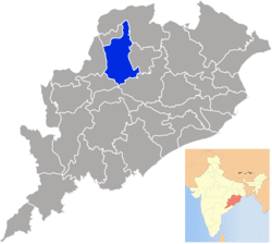
- Map of Sambalpur Odisha
- History
- Asta Sambhus
- Economy
- Demographics
- Languages
- Tourism
- Vidhan sabha constituencies
- References
Map of Sambalpur, Odisha
The district is located in the Mahanadi River basin. It has a total area of 6,702 km2 (2,588 sq mi), of which almost 60% of the district is covered in dense forest. The district is bounded by Deogarh District to the east, Bargarh and Jharsuguda districts to the west, Sundergarh District to the north, and Subarnapur and Angul districts in the south.
Sambalpur City is the connecting city between Chhattisgarh and Odisha. Whereas it used to be known for its importance as a diamond trading centre, nowadays it is mainly known for its textiles, especially the Sambalpuri Saree.
History
Sambalpur is mentioned in the book of Ptolemy (2nd century) as Sambalaka on the river Manada (the Mahanadi River). This gateway to the exotic charms of the western region of Odisha was the cradle of an ancient civilization and is an important landmark in India's cultural history.
Sambalpur State was a former princely state of British India. When its ruler died without a direct male heir in 1849, the British seized the state under the doctrine of lapse. It was attached to the British Bengal Presidency, but was transferred to the Central Provinces in 1862. The district was transferred back to Bengal in 1905, but the subdivisions of Phuljhar and Chandarpur-Padampur remained with the Central Provinces. Bengal's Odisha division became part of the new province of Bihar and Orissa in 1912, and in 1936 became the separate province of Odisha. After Indian Independence in 1947, Odisha became an Indian state.
Earlier Sambalpur District included four districts i.e.; modern day Sambalpur District, Bargarh District Jharsuguda District and Deogarh District which was subsequently divided into four separate districts. Bargarh was separated in 1993, and Jharsuguda and Deogarh districts were separated in 1994.
It is currently a part of the Red Corridor.
Asta Sambhus
In the district of Sambalpur a large numbers of Shiva temples were built during the Chauhan period. The most important amongst them were the Asta Sambhus in the undivided Sambalpur district as detailed below:-
An interesting feature of Saiva shrines found in Sambalpur area is "type of Brahmin Priest" called Chanapati of general caste of these shrines (Pasayat, 1998, 2003, 2004, 2007, 2008).
Economy
The economy of Sambalpur District is basically dependent on agriculture and secondly on forests. Forests play an important role in the economy in terms of contribution to revenue, Domestic Product as well as dependence of people for livelihood. The people living adjacent to the reserved forests of Sambalpur Forest Division are heavily dependent on these forests. In the past Sambalpur has been a great centre of diamond trade. Kendu leaf (Diospyros Melanoxylon) is also produced in Sambalpur. Tendu leaf is one of the most important non-wood forest products of Sambalpur and is also called as green gold of Odisha. Lately industrialisation has started in the district and the prime industries of power, alumina and steel have been established. The place is famous for its globally renowned textile bounded patterns and fabrics locally known as Baandha. Sambalpur is famous for its Hand loom textile works. Popularly known as Sambalpuri Textile. It has earned international fame for its unique pattern, design and texture. Apart from textiles, Samabalpur has a rich tribal heritage and fabulous forestlands.
In 2006 the Ministry of Panchayati Raj named Sambalpur one of the country's 250 most backward districts (out of a total of 640). It is one of the 19 districts in Odisha currently receiving funds from the Backward Regions Grant Fund Programme (BRGF).
Demographics
According to the 2011 census Sambalpur district has a population of 1,044,410, roughly equal to the nation of Cyprus or the US state of Rhode Island. This gives it a ranking of 433rd in India (out of a total of 640). The district has a population density of 158 inhabitants per square kilometre (410/sq mi). Its population growth rate over the decade 2001–2011 was 11.63%. Sambalpur has a sex ratio of 973 females for every 1000 males, and a literacy rate of 76.91%.
Languages
Languages spoken here include Asuri, an Austroasiatic language spoken by approximately 17 000; and Bhunjia, spoken by approximately 7000 Bhunjia Adivasis. Languages spoken in Sambalpur,Burla & Hirakud is Oriya by person migrated from other places of odisha. Other communities speak Hindi and in their own language.90% population speaks Sambalpuri.
Tourism
Samaleswari, the presiding deity of this region is enshrined at 'Samlei Gudi' on the bank of Mahanadi River. The other temple of importance is the Budharaja Temple, dedicated to Lord Shiva and is perched atop the Budharaja hill. These temples are located at a few kilometres' distance from Sambalpur. The Hirakud Dam, the longest dam of the world, is some 15 kilometres from Sambalpur.
Vidhan sabha constituencies
The following is the 4 Vidhan sabha constituencies of Sambalpur district and the elected members of that area