
- elevation 1,041 m (3,415 ft) Length 311 km | - elevation 383 m (1,257 ft) Basin area 5,180 km² | |
 | ||
- location | ||
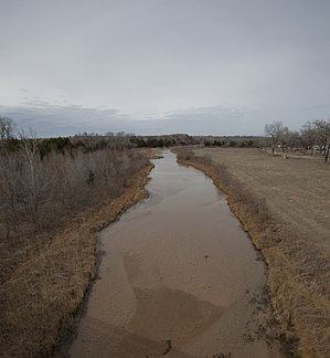
The Salt Fork Red River is a sandy-braided stream about 311 km (193 mi) long, heading on the Llano Estacado of West Texas about 2.9 km (1.8 mi) north of Claude of Armstrong County, Texas, flowing east across the Texas Panhandle and Western Oklahoma to join the Prairie Dog Town Fork Red River about 21 km (13 mi) south of Altus of Jackson County, Oklahoma.
Contents
Map of Salt Fork Red River, United States
CourseEdit
The Salt Fork Red River rises in northeastern Carson County, Texas at coordinates 35°09' N, 101°21' W. It flows southeast across Donley and Collingsworth County, Texas. Crossing into Oklahoma at the 100th meridian, it flows through Harmon County and Greer County, Oklahoma. It turns south near Mangum, Oklahoma and flows through central Jackson County, Oklahoma to its confluence with the Prairie Dog Town Fork Red River about 16 miles (26 km) northwest of Vernon, Texas.