
Website greer.okcounties.org Area 1,668 km² Unemployment rate 4.6% (Apr 2015) | Founded 1896 Population 6,171 (2013) | |
 | ||
Points of interest Quartz Mountain Nature P, Quartz Mountain Fun Park, Old Greer County Museum, Quartz Mountain Water Sli, Quartz Mountain | ||
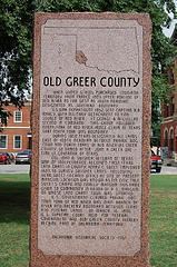
1320 acres in greer county oklahoma
Greer County is a county located along the southwest border of the U.S. state of Oklahoma. As of the 2010 census, the population was 6,239. Its county seat is Mangum. From 1860 to 1896, the state of Texas claimed an area known as Greer County, Texas, which included present-day Greer County along with neighboring areas. In 1896 it was designated as a county in Oklahoma Territory under a ruling by the US Supreme Court.
Contents
- 1320 acres in greer county oklahoma
- Map of Greer County OK USA
- History
- Geography
- Major highways
- Adjacent counties
- Demographics
- Economy
- Communities
- Notable people
- References
Map of Greer County, OK, USA
The rural Greer County is home to Quartz Mountain Nature Park, near the community of Lone Wolf, Oklahoma (known until 2002 as Quartz Mountain State Park). It is also home to the Oklahoma State Reformatory, located in Granite. Its population has declined since 1930 due to changes in agriculture and migration to cities for work.
History
After a dispute over the 1819 Adams-Onís Treaty and the related 1828 Treaty of Limits, the governments of both the United States and the state of Texas claimed ownership of some 1.5 million acres (6,000 km²) in what was then operated as Greer County, Texas. The county was named for former Texas lieutenant governor, John A. Greer. Litigation followed, and in the case of United States v. State of Texas 162 U.S. 1 (1896), with a ruling issued on March 16, the Supreme Court, having original jurisdiction over the case, decided in favor of the United States.
The county was assigned to the Oklahoma Territory on May 4, 1896. When Oklahoma was admitted as a state, Greer County was established according to its current boundaries; the remaining former county area was organized as Harmon, Jackson, and part of Beckham counties. The town of Mangum, designated as the county seat in 1886 when this was part of Texas, continued as the seat of Greer County, Oklahoma.
Originally developed for agriculture, the rural county had its peak of population in 1930. Mechanization of agriculture reduced the need for farm labor, and the population has declined as people migrated to cities for work.
Among the county attractions is Quartz Mountain Nature Park (known until 2002 as Quartz Mountain State Park), near the community of Lone Wolf.
Geography
According to the U.S. Census Bureau, the county has a total area of 644 square miles (1,670 km2), of which 639 square miles (1,660 km2) is land and 4.3 square miles (11 km2) (0.7%) is water.
Western Greer County lies in the Gypsum Hills, while the eastern one-third is in the Red Bed Plains physiographic region. The county is drained by the North Fork Red River, Elm Fork Red River, and Salt Fork Red River.
Major highways
Adjacent counties
Demographics
As of the census of 2000, there were 6,061 people, 2,237 households, and 1,442 families residing in the county. The population density was 10 people per square mile (4/km²). There were 2,788 housing units at an average density of 4 per square mile (2/km²). The racial makeup of the county was 81.46% White, 8.78% Black or African American, 2.47% Native American, 0.26% Asian, 0.02% Pacific Islander, 3.99% from other races, and 3.02% from two or more races. 7.44% of the population were Hispanic or Latino of any race.
There were 2,237 households out of which 25.60% had children under the age of 18 living with them, 51.00% were married couples living together, 9.60% had a female householder with no husband present, and 35.50% were non-families. 33.40% of all households were made up of individuals and 19.80% had someone living alone who was 65 years of age or older. The average household size was 2.27 and the average family size was 2.87.
In the county, the population was spread out with 20.00% under the age of 18, 9.10% from 18 to 24, 28.40% from 25 to 44, 22.40% from 45 to 64, and 20.00% who were 65 years of age or older. The median age was 40 years. For every 100 females there were 123.80 males. For every 100 females age 18 and over, there were 129.60 males.
The median income for a household in the county was $25,793, and the median income for a family was $30,702. Males had a median income of $24,318 versus $18,641 for females. The per capita income for the county was $14,053. About 15.00% of families and 19.60% of the population were below the poverty line, including 28.40% of those under age 18 and 14.80% of those age 65 or over.
Economy
The county's economy has been based on farming and raising livestock. In 1907, the main crops were cotton, corn, oats, wheat and alfalfa. Livestock raised includes cattle, horses, mules, swine, sheep and goats.
The Oklahoma State Reformatory is located in Granite in the county and provides some jobs.