
Preceded by Succeeded by | Government Principality Founded 1574 | |
 | ||
Historical era Middle Ages, Modern Age | ||
sterreichischer milit rmarsch rheingraf salm salm fanfarenmarsch
The Principality of Salm-Salm was a state of the Holy Roman Empire. It was located in the present-day French départements of the Bas-Rhin and the Vosges and was one of a number of partitions of Salm.
Contents
- sterreichischer milit rmarsch rheingraf salm salm fanfarenmarsch
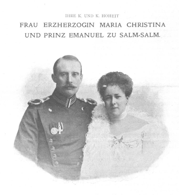
- Felix prinz zu salm salm with the rheingraf and prinz salm winery
- History
- Geography
- Counts and Princes of Salm and Salm Salm 15741738
- References
Felix prinz zu salm salm with the rheingraf and prinz salm winery
History

Salm-Salm was created as a partition of Salm-Dhaun in 1574, and was raised from a County to a Principality in 1739 after being inherited and renamed by Count Nicholas Leopold of Salm-Hoogstraten. Salm-Salm was partitioned between itself and Salm-Neuweiler in 1608.
The last territorial partition occurred in 1751, when Salm-Salm reorganized its borders with the Duchy of Lorraine.

In 1790, after the French Revolution, the princes of Salm fled the territory and moved to their castle in Anholt, Westphalia. Salm-Salm then was besieged by the revolutionary army, which blocked food supplies from reaching the state. As a consequence, the population was forced to surrender to France. On March 2, 1793, the French National Convention declared Salm-Salm to be a part of the French Republic and attached it to the Départment of the Vosges. This was recognized by the Holy Roman Empire in the Peace of Lunéville of 1801.
Some years later, in 1802/1803, together with Salm-Kyrburg, the prince of Salm-Salm was granted new territories formerly belonging to the Bishops of Münster (Westphalia). The new territory was governed in union with Salm-Kyrburg and was known as the Principality of Salm.
Geography

In 1165, the original County of Salm was divided into the counties of Lower Salm, in the Ardennes, and the county of Upper Salm, situated in the Vosges mountains. In 1738, the County of Upper Salm was elevated to Principality of Salm-Salm.
The capital of Salm-Salm was first Badonviller, and from 1751 on, Senones. The second part of the name of Salm-Salm derives from Salm Castle near Salm (today La Broque).
At the end of its existence, Salm-Salm had an area of about 200 km² and 10,000 inhabitants. It was separated from the main part of the Holy Roman Empire when most of Alsace was ceded to France in the 17th century. Until 1766, it was bordered by the Duchy of Lorraine to the west and by France to the east. After Lorraine became a part of France on 24 February 1766, Salm-Salm formed an exclave of the Holy Roman Empire surrounded by French territory.
The economy of Salm-Salm was mainly based on an iron mine near Grandfontaine.