
 | ||
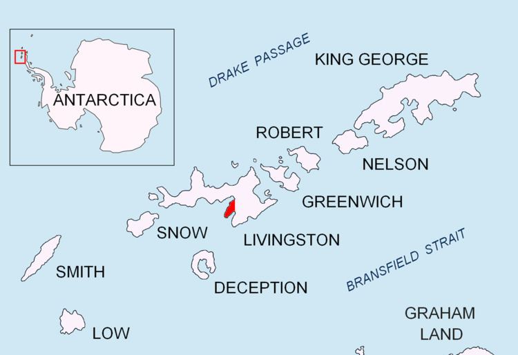
Salisbury Bluff is the point forming the south side of the entrance to Las Palmas Cove in Hurd Peninsula, Livingston Island in the South Shetland Islands, Antarctica and surmounted by a 161 m height. The area was visited by early 19th century sealers operating from nearby Johnsons Dock.
Contents
The feature is named after the British sealing vessel Salisbury under Captain Thomas Hodges that visited the South Shetlands in 1820-21.
Location
The point is located at 62°41′10.9″S 60°25′35.6″W which is 1.39 km south-southwest of Henry Bluff, 3.82 km north by east of Miers Bluff and 10.19 km east-southeast of Hannah Point (British mapping in 1968, detailed Spanish mapping in 1991, Bulgarian mapping in 2005 and 2009).
Maps
References
Salisbury Bluff Wikipedia(Text) CC BY-SA