
Highest elevation N/A ft (N/A m) Area 4,981 km² | Lowest elevation N/A ft (N/A m) | |
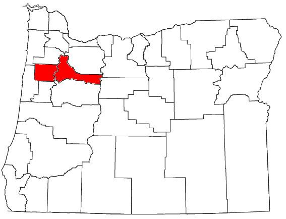 | ||
The Salem Metropolitan Statistical Area (MSA), as defined by the United States Census Bureau, is an area consisting of two counties in western Oregon, Marion and Polk. The principal city is Salem, the state capital, which has a population of 154,637. As of the 2010 census, there were 390,738 people living in the Salem MSA. In 2000, the MSA had a population of 347,214, and had a population of 278,024 according to the 1990 census.
Contents
Counties
Places with more than 125,000 inhabitants
Places with 10,000 to 40,000 inhabitants
Places with 1,000 to 10,000 inhabitants
Places with fewer than 1,000 inhabitants
Unincorporated places
Demographics
As of the census of 2010, there were 390,738 people living in the area, a 12.5% increase over the 347,214 residents as of the 2000 census. The metro area also had 151,250 households and a population density of 203.2 inhabitants per square mile (78.5/km2) at Census 2010. The racial makeup of the MSA was 71% White, 0.8% African American, 1.2% Native American, 1.8% Asian, 0.6% Pacific Islander, .1% from other races, and 2.4% from two or more races. Hispanic or Latino of any race were 21.9% of the population.
As of 2000, the median income for a household in the MSA was $41,313, and the median income for a family was $48,343. Males had a median income of $35,254 versus $26,278 for females. The per capita income for the MSA was $18,845.