
Local time Wednesday 6:45 PM | Time zone AEST (UTC+10) | |
 | ||
Weather 27°C, Wind SE at 2 km/h, 89% Humidity | ||
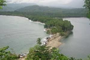
Salamaua (German: Samoahafen) was a small town situated on the northeastern coastline of Papua New Guinea, part of Morobe province. The settlement was built on a minor isthmus between the coast with mountains on the inland side and a headland. The closest city is Lae, which can be reached only via boat across the gulf.
Contents
Map of Salamaua, Papua New Guinea
History
In the 1920s prospective gold miners used Salamaua as a staging post to explore for gold in the inland areas. Gold was discovered at Wau and miners came from all over and made for the goldfields via the rough Black Cat Track.
The town was captured by the Japanese on 8 March 1942 during World War II and later retaken by Australian and United States forces led by General Douglas MacArthur on 11 September 1943 during the Salamaua-Lae campaign. During reoccupation the town was destroyed.
Today the villages of Kela and Lagui occupy the site, as well as holiday houses, mainly for expatriates based in Lae.