
- elevation 6,487 ft (1,977 m) Length 225 km Source Bitterroot Mountains | - elevation 2,129 ft (649 m) Basin area 4,791 km² Mouth Lake Coeur d'Alene | |
 | ||
- location | ||
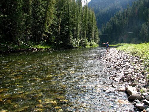
The Saint Joe River (sometimes abbreviated St. Joe River) is a 140-mile (225 km) long tributary of Coeur d'Alene Lake in northern Idaho. Beginning at an elevation of 6,487 feet (1,977 m) in the Northern Bitterroot Range of eastern Shoshone County, it flows generally west through the Saint Joe River Valley and the communities of Avery and Calder. Past Calder, it flows into Benewah County and through the town of St. Maries, where it receives its largest tributary, the Saint Maries River. It then turns northwest, passing through Heyburn State Park before reaching its mouth just north of the Kootenai County line. Much of the river's route through Heyburn State Park is partially flooded due to raised water levels from Post Falls Dam on the Spokane River below Coeur d'Alene Lake. With a mouth elevation of 2,129 feet (648.9 m), it has been described as the highest navigable river in the world.
Map of St Joe River, Idaho, USA
In 1978, 66.3 miles (107 km) of the river were protected by the National Wild and Scenic Rivers System, with 26.6 miles (42.8 km) designated as wild and another 39.7 miles (63.9 km) designated as recreational.
The Saint Joe River drains 1,850 square miles (4,791 km2) of the Idaho Panhandle. It is part of the Spokane River watershed, which in turn is part of the Columbia River basin. About 68 percent is owned by the United States Forest Service (the St. Joe National Forest), 4 percent is owned by the Bureau of Land Management, 2 percent is owned by the State of Idaho, and the rest is privately owned.
The Saint Joe River watershed is covered primarily by mixed coniferous forest, which includes species such as Douglas fir, true fir, larch, and pine. Alder is common in the riparian zones of high altitude river valleys, while cottonwood dominates the lower altitude riparian zones, much of which have been converted to agricultural land. Rush, sedge, and cattails are common in the river's floodplains, which are also used to grow wild rice.
The river is home to many species of fish, including native westslope cutthroat trout, mountain whitefish, cedar sculpin and other cottids, shiners, and nonnative rainbow and brook trout, chinook and Kokanee Salmon. The upper Saint Joe River is also home to the last self-sustaining population of vulnerable bull trout in the Coeur d'Alene Lake watershed.