
Length 30 km (19 mi) | Elevation 3,192 m (10,472 ft) Highest point Rossbodenstock Mountains Rossbodenstock | |
 | ||
Cantons ListGraubündenTicinoUriValais Similar | ||
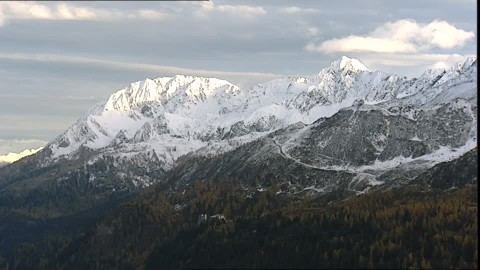
The Saint-Gotthard Massif (German: Gotthardmassiv or Sankt-Gotthard-Massiv) is a mountain range in the Alps in Switzerland, located at the border of four cantons: Valais, Ticino, Uri and Graubünden. It is delimited by the Nufenen Pass on the west, by the Furka Pass and the Oberalp Pass on the north and by the Lukmanier Pass on the east. The homonymous Gotthard Pass, lying at the heart of the massif, is the main route from north to south (excluding tunnels).
Contents
Map of Saint-Gotthard Massif, 3999 Obergoms, Switzerland
Peaks
The highest peaks of the massif are Pizzo Rotondo (3,192 m) in the southwest, Pizzo Centrale (2,999 m) near the centre and Piz Gannaretsch (3,040 m) in the northeast. There is no peak named Saint-Gotthard.
Tunnels
There are three long tunnels traversing the Saint-Gotthard Massif:
References
Saint-Gotthard Massif Wikipedia(Text) CC BY-SA