
INSEE/Postal code 06118 /06530 Population 2,840 (1999) | Time zone CET (UTC+1) Area 30.02 km² Local time Tuesday 6:42 PM | |
 | ||
Weather 16°C, Wind S at 11 km/h, 58% Humidity | ||
Saint-Cézaire-sur-Siagne is a commune in the Alpes-Maritimes department in southeastern France.
Contents
Map of 06530 Saint-C%C3%A9zaire-sur-Siagne, France
Geography
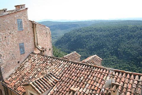
Far from the major thoroughfares, Saint-Cézaire-sur-Siagne lies halfway between the beaches of the Côte d'Azur and the ski resorts of the Maritime Alps. It is located on a plateau at 475 m. Protected from north winds by the alpine foothills around Grasse, it enjoys an exceptionally tempered climate.
Saint-Cézaire-sur-Siagne is located at the extreme west end of Alpes-Maritimes, perched on a spur that dominates the valley of the Siagne.
Saint-Cézaire lies 15 km southwest of Grasse, 30 km from Cannes, and 52 km from Nice.
On the north are Escragnolles and Saint-Vallier-de-Thiey. To the south are Spéracèdes and Le Tignet. On the southwest are the valley of the Siagne and the massif of Tanneron, which forms the boundary between Alpes-Maritimes and the department of Var.