
Traditional Chinese 西環 Literal meaning West Ring Jyutping sai1 waan4 | Simplified Chinese 西环 Hanyu Pinyin | |
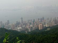 | ||
Trip to sai wan beach sai kung hong kong
Sai Wan (Chinese: 西環, Western District or simply Western) is an area in Hong Kong Island, Hong Kong that corresponds to Sai Ying Pun, Shek Tong Tsui, Belcher Bay and Kennedy Town. However, Some Hong Kong people consider Kennedy Town as the only part of Sai Wan. It formed part of the City of Victoria. West Point, a former cape where major government structures in Sai Wan are close to, also used to refer to Sai Wan. After Hong Kong's handover to People's republic of China, Sai Wan become the location for Liaison Office of the Central People's Government in the Hong Kong Special Administrative Region and people in Hong Kong tend to refer the name Sai Wan as the PRC office itself..
Contents
Sai wan beach hike sai kung hong kong vlog
History of Sai Ying Pun
In the early 1800s, Sai Ying Pun was known as a place to settle the Chinese immigrants. It was built from the west of Tai Ping Shan. Europeans were also assigned to live in the same area. However, they were separated at the High Street where Chinese were excluded from living.
In 1880, sewerage was installed into the area, with the main flow coming down Centre Street. Streets were covered with macadam and concreted at the same time.
In 1890s, a severe epidemic outbreak of the bubonic plague afflicted Sai Ying Pun residents. Sheung Fung Lane residents were almost wiped out during the period. Government Reports identified this area as the no. IX health district and went into great detail about the buildings where the disease occurred. The neighboring area, Tai Ping Shan, was the most infected place in the city. It was resumed, abandoned and demolished to improve hygiene.
History of Shek Tong Tsui
The name of Shek Tong Tsui derived from a famous ancient stone pond, "Shek Tong" (石塘) in Cantonese, inside the area. The stone pond was located at modern-day Hill Road and The Belcher's, and was mined by the Hakka people since the 17th century.
In 1903, the first land reclamation of Shek Tong Tsui was finished. In the meantime, the largest brothels in the city, which were located at the Possession Street, were destroyed by a big fire. Consequently, Hong Kong Governor Matthew Nathan decided to move all Hong Kong Island's brothels to Shek Tong Tsui in the early 1900s due to the large area recently claimed from the land reclamation. The place was then being well flourished as a red light district and came to its golden period. Numerous Cantonese opera theaters and restaurants were founded because of the business of brothels. It was the best place to entertain the affluent Chinese in Hong Kong.
Queen's Road was the first road built in Hong Kong, constructed by the British from 1841 to 1843. It connected the Victoria City from Shek Tong Tsui to Wan Chai.
Brothels in this area had also inspired numerous novels and Hong Kong films, most notably Rouge (1987), starring Anita Mui and Leslie Cheung.
History of Belcher Bay
Belcher Bay was named after Edward Belcher who landed on Possession Point at the north shore of Hong Kong Island and made the first British survey of Hong Kong Harbour on the 25th January 1841.
Belcher Bay, Gin Drinkers Bay and Tseung Kwan O were known as the 'Bay of Trash' in Hong Kong.
Belcher's Street is the main street in Kennedy Town of Hong Kong. It connects Victoria Road and Queen's Road West. A small section in its west end built a turn around for Hong Kong Tramway.
It is currently used as a site for ships to load and unload goods.
History of Kennedy Town
Kennedy Town was the western section of the historical Victoria City. It was named after the governor Arthur Edward Kennedy who initiated land reclamation along the coast of this area in 1886. It formed a narrow coastal strip of land that included the Kennedy Praya and the coastal area from Beach Street via Collinson Street to Shek Tong Tsui.
In 1903, the Hong Kong Government erected seven boundary stones for the city, inscribed "City Boundary 1903". One of them is located at the Kennedy Town Temporary Recreation Ground at Sai Ning Street (西寧街).
From 1933 to 1939, more land was reclaimed along the coast of Kennedy Town, yet the construction was suspended due to the Battle of Hong Kong in 1941. Another land reclamation was conducted recently at the end of the 20th century.