
Area 10,252 km² Lok sabha constituency Sagar | ||
 | ||
Website [sagar.nic.in Official website] Points of interest Khurai Fort, Rahatgarh Fort, University Botanical Garden, Khimlasa Fort, Ghanta Ghar | ||
Sagar District is a district of Madhya Pradesh state in central India. The town of Sagar serves as its administrative center.
Contents
- Map of Sagar Madhya Pradesh
- Geography
- Demographics
- Dayasagar Ji Mararaj Nemingar Jain Tirth
- Shri Parsvanath Digamber Jain Atishaya Kshetra Pateria
- Makronia Sagar
- Notable personalities
- References
Map of Sagar, Madhya Pradesh
The district has an area of 10,252 km², and a population of 2,021,783 (2001 census), a 23% increase from its 1991 population of 1,646,198. Sagar is bounded by Lalitpur District of Uttar Pradesh state to the north, and the Madhya Pradesh districts of Chhatarpur to the northeast, Damoh to the east, Narsinghpur to the south, Raisen to the southwest, Vidisha to the west, and Ashoknagar to the northwest. Sagar district is dominated by Sonis, Jains and Yadavs.kushwahas
As of 2011 it is the third most populous district of Madhya Pradesh (out of 50), after Indore and Jabalpur.
Geography
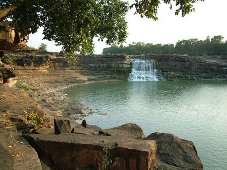
Sagar District is an extensive and elevated plain, broken in places by the low hills of the Vindhyan sandstone. It is traversed by numerous rivers and streams, chief of which are the Sunar, Beas, Dhasan and Bina, all of which flow in a northerly direction towards the valley of the Ganges. In the southern and central areas the soil is black. This is due to decaying vegetation. To the north and the east there is a reddish-brown alluvium. Iron ore of excellent quality is found and worked at Hirapur, a small village in the extreme north-east. The district contains several densely wooded tracts, the largest of which is the Ramna teak forest preserve in the north.
Demographics
According to the 2011 census, Sagar District has a population of 2,378,295, roughly equal to the nation of Latvia or the US state of New Mexico. This gives it a ranking of 188th in India (out of a total of 640). The district has a population density of 232 inhabitants per square kilometre (600/sq mi) . Its population growth rate over the decade 2001–2011 was 17.62%. Sagar has a sex ratio of 896 females for every 1000 males, and a literacy rate of 77.52%.
Dayasagar Ji Mararaj Nemingar Jain Tirth
Neminagar Jain Tirth is in Banda tehsil located 30 km from Sagar on National Highway NH-86. It was built in the name of Aacharya Shri 108 Nemisagar ji maharaj by the blessings of his disciple aacharya 108 shri dayasagar ji maharaj. This temple has one choubisi (24 tirthankars god on 24 different altar) one levitated trikal choubisi (Lords of time passes, the time now and time to be) and a navagraha mandir (Lords of nine planets).
Shri Parsvanath Digamber Jain Atishaya Kshetra, Pateria
Shri Parsvanath Digamber Jain Atishaya Kshetra, Pateriaji is a 232 years old temple dedicated to Parshvantha. This idol is 7 feet in height in Padmasana posture build in Black Stone with three serpent hoods. This temple was built, by Seth Radha Kishanjun Shah by the earnings of one day in the business of Cotton in 1782 (V.S. 1839). Manasthambha of this temple is considered miraculous and is said that it cures diseases.
Makronia, Sagar
A former Dr H S Gour University started from Makronia's SAF Campus so many Historic event is connected through makronia, This region is developing as the suburban region near Sagar city. It is just 5 km away from city. It has its separate railway station. It has the biggest hotel of Sagar the 3 star Paradise hotel, many CBSE and MP board schools as well as government engineering college. many army bases are located in makronia. Also makronia Nagar Palika, there are many Engineering Colleges in Makronia, as there's shortage of space in the City the development is moving towards Makronia Region.