
Type Tiered–cascade Number of drops 2 | Elevation 295 m Watercourse Russell Falls Creek | |
 | ||
Total height 34–58 metres (112–190 ft) Similar Horseshoe Falls, Cradle Mountain, Freycinet National Park, Mount Wellington, Lady Barron Falls | ||
Russell falls mount field national park tasmania
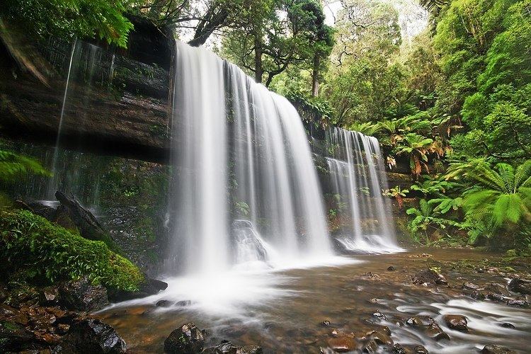
The Russell Falls, a tiered–cascade waterfall on the Russell Falls Creek, is located in the Central Highlands region of Tasmania, Australia.
Contents
Russell falls tasmania
Location and features
The Russell Falls are situated on the eastern boundary of Mount Field National Park, 100 metres (330 ft) downstream of the Horseshoe Falls, approximately 70 kilometres (43 mi) northwest of Hobart via the Brooker and Lyell highways. Accessible by a paved walking track, the falls are a popular tourist attraction. The waterfall descends over horizontal marine Permian siltstone benches, while the vertical faces of the falls are composed of resistant sandstone layers.
They were first named the Brownings Falls after the original discoverer, circa1856, but were known as the Russell Falls after 1884, by which time they were already a popular tourist attraction. The Falls Reserve was established in 1885 and in 1899 the Russell Falls were selected as one of eight images to be used on a set of pictorial postage stamps, aimed at promoting the then colony's growing tourist industry.