
Type Cataract Total width 2,700 ft (820 m) Height 53 m | Total height 167 ft (51 m) Elevation 156 m Number of drops 1 Phone +1 905-356-2241 | |
 | ||
Similar | ||
Niagara falls horseshoe falls american falls bridal veil in high definition
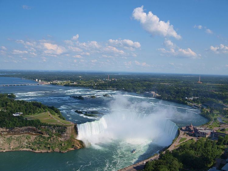
Horseshoe Falls, also known as Canadian Falls, is part of Niagara Falls, on the Niagara River. Approximately 90% of the Niagara River, after diversions for hydropower generation, flows over Horseshoe Falls. The remaining 10% flows over American Falls. It is located between Terrapin Point on Goat Island in the US state of New York, and Table Rock in the Canadian province of Ontario.
Contents
- Niagara falls horseshoe falls american falls bridal veil in high definition
- Brink of death on the brink of niagara s horseshoe falls
- International Border
- References
Brink of death on the brink of niagara s horseshoe falls
International Border
When the boundary line between the United States and Canada was determined in 1819 based on the Treaty of Ghent, the northeastern end of the Horseshoe Falls was in New York, United States, flowing around the Terrapin Rocks, which was once connected to Goat Island by a series of bridges. In 1955 the area between the rocks and Goat Island was filled in, creating Terrapin Point. In the early 1980s the United States Army Corps of Engineers filled in more land and built diversion dams and retaining walls to force the water away from Terrapin Point. Altogether 400 feet (120 m) of the Horseshoe Falls was eliminated. Due to erosion, the falls will continue to move in relation to the boundary line in the future.
The official national maps for both Canada and the United States indicate that a small portion of the Horseshoe Falls is located within the United States.