
Elevation 13,205 ft (4,025 m) Countries Antarctic, Antarctica | Continent Antarctica | |
 | ||
Mountains Mount Lister, Bishop Peak, Margaret Hill | ||
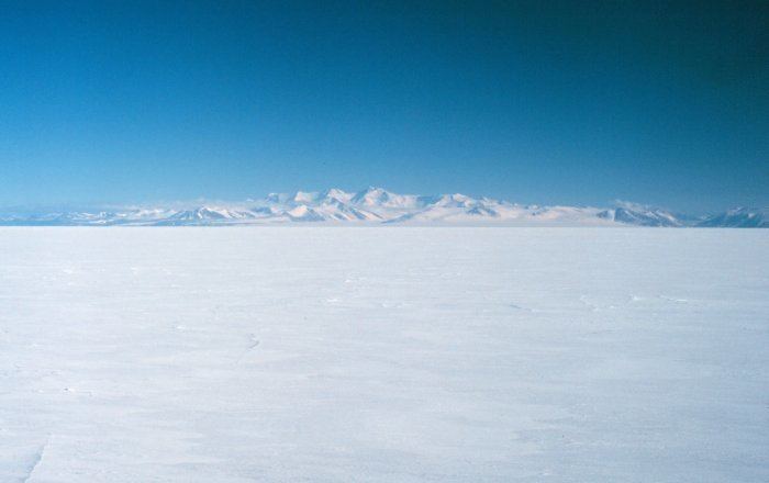
Royal society range antarctica
The Royal Society Range (78°10′S 162°40′E) is a majestic mountain range in Victoria Land, Antarctica. With its summit at 4,025 metres (13,205 ft), the massive Mount Lister forms the highest point in this range. Mount Lister is located along the western shore of McMurdo Sound between the Koettlitz, Skelton and Ferrar glaciers. Other notable local terrain features include Allison Glacier, which descends from the west slopes of the Royal Society Range into Skelton Glacier.
Contents
- Royal society range antarctica
- Map of Royal Society Range Antarctica
- Discovery and naming
- Geology
- Koettlitz Glacier Alkaline Province
- Volcanic history
- References
Map of Royal Society Range, Antarctica
Discovery and naming
The range was probably first seen by Captain James Clark Ross in 1841.
The range was explored by the British National Antarctic Expedition (BrNAE) under Robert Falcon Scott, who named the range after the Royal Society and applied names of its members to many of its peaks. For example, Mount Lister was named for Lord Joseph Lister, President of the Royal Society, 1895-1900. The Royal Society provided financial support to the expedition and its members had assisted on the committee which organized the expedition.
Geology
The Royal Society Range consists of a Precambrian igneous and meta-igneous basement complex overlain by Devonian- to Triassic-age sandstones, siltstones and conglomerates of the Beacon Supergroup which dip shallowly westward away from the Ross Sea coast. The entire region is cut by north-south trending longitudinal faults, east-west trending transverse faults, and structurally related dike swarms.
Tectonic and fluvial activity have featured very heavily in the recent geologic history of the Royal Society Range. Following the extension of the Ross Sea Basin (c. 55 million years ago), an episode of uplift drove the creation of the Royal Society Range rift flank. At this time a tectonic (though not accretionary) wedge, up to 6 km thick on the coast, was present, though it quickly began to erode due primarily to fluvial processes, and the Royal Society Range was cut down near to its present appearance by the mid-Miocene. Relatively limited glacial action since that time has preserved much of the fluvial architecture of the Range, and though uplift did not cease, its magnitude is such that it has not drastically affected the landscape, having progressed only 67 meters in the last 8 million years.
Koettlitz Glacier Alkaline Province
Neoproterozoic tectonic extension along the edge of the East Antarctic Craton between the Skelton and Koettlitz Glaciers resulted in the emplacement of coarse grained alkaline igneous intrusive rocks (ranging from gabbro to A-type granite). This area of alkaline intrusives is referred to as the Koettlitz Glacier Alkaline Province
Ross Orogeny
Cambrian tectonic convergence, continental collision and plate subduction led to the emplacement of calc-alkaline and adakitic granitoids. This period of mountain building is referred to as the Ross Orogeny.
Volcanic history
The Royal Society Range contains over 50 basaltic vents, ranging in size from tiny mounds to cinder cones up to 300 meters (985 feet) high. Dating of surface material indicates they were active earlier than 15 million years ago (e.g. Heald Island) and as recently as 80,000 years ago, with glacier-bound tephra layers suggesting even more recent Holocene activity. The vast majority of vents are located in the foothills of the Royal Society mountains just north of Koettlitz Glacier, and most are Quaternary in age. Most emanating flows are 3–10 meters thick and less than 4 kilometers long. The composition, with very few exceptions, is porphyritic basanite with primarily olivine and clinopyroxene phenocrysts, though some phenocrystic plagioclase is also present.