
Founded 1753 Website www.co.rowan.nc.us Population 138,323 (2013) | Area 1,357 km² | |
 | ||
Colleges and Universities Rowan–Cabarrus Community College, Catawba College, Livingstone College, Hood Theological Seminary Points of interest North Carolina Transport, Lazy 5 Ranch, Baker's Creek Park, Gold Hill Mines Historic P, Salisbury Vistors Center | ||
Holiday caravan parade in salisbury rowan county north carolina
Rowan County is a county located in the U.S. state of North Carolina. As of the 2010 census, the population was 138,428. Its county seat is Salisbury. Rowan County is included in the Charlotte metropolitan area.
Contents
- Holiday caravan parade in salisbury rowan county north carolina
- Map of Rowan County NC USA
- Historic preservation in rowan county north carolina
- History
- Geography
- Adjacent counties
- Major highways
- Demographics
- Law and government
- Colleges
- RowanSalisbury School System
- Kannapolis City Schools
- Private schools
- Libraries
- Media
- Cities
- Census designated place
- Unincorporated communities
- Notable people
- References
Map of Rowan County, NC, USA
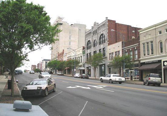
Historic preservation in rowan county north carolina
History
The first Europeans to enter what is now Rowan County came with the Spanish expedition of Juan Pardo in 1567. They established a fort and a mission in the native village of Guatari, believed to be located near the Yadkin River and inhabited by the Wateree. At the time, the area was ruled by a female chief the Spaniards called Guatari Mico. The Spaniards called the village Salamanca in honor of the city of Salamanca in western Spain, and established a mission, headed by a secular priest named Sebastián Montero. The Spaniards abandoned the area at some point before 1572.
The county was formed in 1753 from the northern part of Anson County. It was named for Matthew Rowan, acting governor of North Carolina from 1753 to 1754. It was intended to incorporate all of the lands of the Granville District that had heretofore been included in Anson County.
Originally, Rowan County was a vast territory with an indefinite western boundary. Reductions in its extent began in 1770, when the eastern part of it was combined with the western part of Orange County to become Guilford County, North Carolina. In 1771 the northeastern part of what remained of Rowan County became Surry County. In 1777 the western part of Rowan County became Burke County. In 1788 the western part of the now much smaller Rowan County became Iredell County. In 1822 the eastern part of the still shrinking county became Davidson County. Finally, in 1836 the part of Rowan County north of the South Yadkin River became Davie County.
The "250 Fest" celebrating the 250th anniversary of Rowan County occurred in 2003.
Geography
According to the U.S. Census Bureau, the county has a total area of 524 square miles (1,360 km2), of which 511 square miles (1,320 km2) is land and 12 square miles (31 km2) (2.4%) is water.
The county's eastern border is formed by the Yadkin River. North of Ellis Crossroads, the South Yadkin River meets the Yadkin. The South Yadkin forms the county's northern border, with Davie County.
The southern border is an east-west line that bisects the city of Kannapolis.
Adjacent counties
Major highways
Interstate 85 passes through the county from southwest to northeast. In the early 2000s, I-85 underwent an extensive widening in the central and northern part of the county, from exit 68, US 29 Connector north almost to the Davidson county line. A new bridge over the Yadkin River is planned.
U.S. Route 70 enters the northwestern part of Rowan county, west of Cleveland. It runs southeast into Salisbury, where it follows Jake Alexander Boulevard to the southeast and then joins US 29 North as Main Street. US 70 continues northeast as Main Street and then Salisbury Avenue in Spencer before crossing into Davidson County.
U.S. Route 29 forms Main Street in Kannapolis, China Grove, and Landis in the southern part of the county. It joins US 70 as Main Street through Salisbury, and as Salisbury Avenue in Spencer.
U.S. Route 52 is the main artery for the southeastern part of the county, serving the towns of Gold Hill, Rockwell and Granite Quarry. Just before reaching downtown Salisbury, US-52 joins Interstate 85, which it follows into Davidson county.
Demographics
As of the census of 2010, there were 138,428 people, 53,140 households, and 37,058 families residing in the county. The population density was 270.7 people per square mile (98/km²). There were 60,211 housing units at an average density of 117.7 per square mile (41/km²). The racial makeup of the county was 76.52% White, 16.18% Black or African American, 0.34% Native American, 1.00% Asian, 0.035% Pacific Islander, 4.33% from other races, and 1.60% from two or more races. 7.69% of the population were Hispanic or Latino of any race.
Of the 53,140 households, 29.30% had children under the age of 18 living with them, 50.20% were married couples living together, 8.49% had a female householder with no husband present, 5.41% had a male householder with no wife and 30.26% were non-families. 25.22% of all households were made up of individuals and 10.15% had someone living alone who was 65 years of age or older. The average household size was 2.52 and the average family size was 3.00.
In the county, the population was spread out with 23.80% under the age of 18, 9.00% from 18 to 24, 25.40% from 25 to 44, 27.40% from 45 to 64, and 14.40% who were 65 years of age or older. The median age was 39.1 years. For every 100 females there were 97.57 males. For every 100 females age 18 and over, there were 95.28 males.
According to the 2000 Census, The median income for a household in the county was $37,494, and the median income for a family was $44,242. Males had a median income of $31,626 versus $23,437 for females. The per capita income for the county was $18,071. About 8.10% of families and 10.60% of the population were below the poverty line, including 13.70% of those under age 18 and 11.40% of those age 65 or over.
Law and government
The primary governing body of Rowan County follows a council–manager government format with a five-member Board of Commissioners and the County Manager. The current County Manager is Aaron Church. The current Commissioners are: Greg Edds (Chairman), Jim Greene (Vice-Chairman), Judy Klusman, Mike Caskey and Craig Pierce. Commissioners are elected to four year terms with three being elected during midterm elections and two being elected during presidential elections. The commission passes the Code of Ordinances for the county.
Rowan County is a member of the regional Centralina Council of Governments.
In the State Legislature, Rowan is represented in the Senate by Andrew C. Brock in the 34th district and Tom McInnis in the 25th. In the House, Rowan is represented by Carl Ford in the 76th district and Harry Warren in the 77th district. Both Senators and House Representatives are elected to two year terms.
In the US Senate, the county is represented by Richard Burr and Thom Tillis. Rowan is split between two US House districts, the 8th congressional district and North Carolina's 13th congressional district
The current Sheriff of Rowan County is Kevin L. Auten who took over the position after the retirement of George Wilhelm in 2009. Auten won election to a full term in 2010.
Colleges
Rowan–Salisbury School System
The Rowan–Salisbury School System is a PK-12 graded school district in North Carolina covering nearly all of Rowan County. The 35 schools in the district serve 20,887 students as of 2009-2010. It was formed in 1989 with the merger of Rowan County Schools and Salisbury City Schools.
Kannapolis City Schools
Students living in the portion of Kannapolis located in Rowan County (the city is mostly in Cabarrus County) attend Kannapolis City Schools, which operates independently of the countywide school systems.
Private schools
Libraries
Media
The Salisbury Post, founded in 1905, is the local daily newspaper.