
Elevation 2,832 m | Mountain range Stubai Alps | |
 | ||
Similar Zwieselbacher Rosskogel, Hohe Villerspitze, Lampsenspitze, Zischgeles, Lisenser Fernerkogel | ||
The Roter Kogel is a mountain, 2,832 m (AA), in the Stubai Alps in the Austrian state of Tyrol.
Contents
Map of Roter Kogel, 6184, Austria
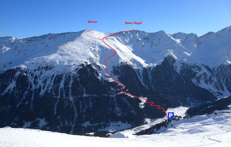
It lies on a ridge that runs from the Hohe Villerspitze over the Lüsener Villerspitze (3,027 m (AA)) northwards as far as the Fotscher Windegg (2,577 m (AA)). West of this chain lies the Lüsener Valley and the village of Praxmar, a starting point for an ascent of the Roter Kogel. East of the Roter Kogels stretches the valley of Fotscher Tal, where there are two other bases: the Alpengasthof Bergheim Fotsch (1,464 m (AA)) and the Potsdamer Hut. This ascent up the eastern side is also a popular ski tour in winter.
LiteratureEdit
References
Roter Kogel Wikipedia(Text) CC BY-SA