
Total length 377 metres (1,237 ft) Length 377 m Opened 2 April 1966 | Clearance above 17 m Material Concrete | |
 | ||
Maintained by NSW Roads & Maritime Services Similar Middle Harbour, Garigal National Park, Captain Cook Bridge - N, Tom Uglys Bridge, Davidson Park | ||
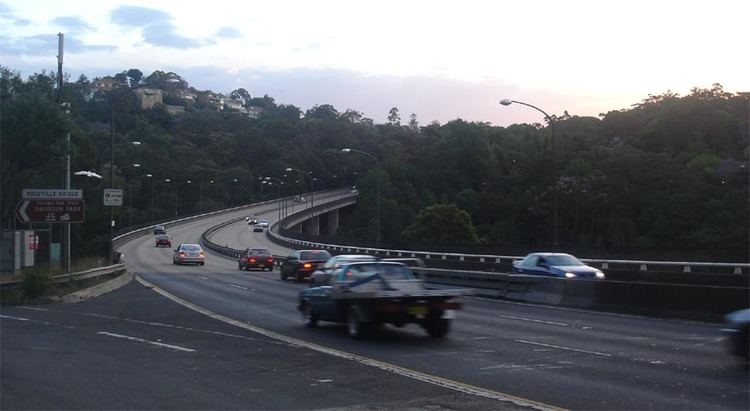
The Roseville Bridge, a concrete box girder bridge located adjacent to the suburb of Roseville, crosses the Middle Harbour in Sydney, New South Wales, Australia. The bridge carries Warringah Road, part of the A38; and is one of two crossings of Middle Harbour inclusive of the Spit Bridge.
Contents
The bridge is 377 metres (1,237 ft) long has a clearance of 17.4 metres (57 ft) from the water below. However, the adjacent Pipe Bridge has a clearance of only 11 metres (36 ft). This limitation, combined with only 1.5 metres (4 ft 11 in) depth of water, make it out of reach for most cruising vessels.
History
An original bridge across Middle Harbour at Roseville was built jointly by the Willoughby, Ku-ring-gai and Warringah councils. It was built of reinforced concrete by unemployed returned servicemen and opened on 20 September 1924. It was claimed to be the longest bridge of that type in NSW although the bridge across the Hawkesbury River at North Richmond was longer. It was claimed to be the first bridge supported on reinforced concrete piles. This low-level two-lane bridge was located downstream of the current bridge, and connected Babbage Road to what is today called Healey Way, which is the entrance to Davidson Park within Garigal National Park. The first bridge replaced an earlier ferry service consisting of rowing boats across the narrowest section of water.
The suburbs east of Middle Harbour grew rapidly in the years following the opening of Roseville Bridge and on 2 April 1966 the Liberal Premier Robin Askin, the Member for Collaroy at the time, later the Member for Pittwater, opened the current six-lane, high-level bridge. Along with the bridge, a significant upgrade of the approach roads was completed, which became the six-lane Warringah Road. This upgraded section of road is about 2 kilometres (1.2 mi) long.
The 1924 bridge survived the opening of the new bridge, and provided pedestrian access only, until it was demolished in 1974, along with Roseville Baths. Almost nothing remains from these structures.
Current use
Today Roseville Bridge is part of a major thoroughfare from the Pacific Highway at Roseville to the Northern Beaches and suburbs east of Middle Harbour. Due to the halt of the construction of the Warringah Expressway across Middle Harbour to Wakehurst Parkway and the Burnt Bridge Creek Deviation, which is the only part of the Warringah Expressway built on the Northern Beaches by the Labor Wran government, there are today only two other major roads to these areas: Mona Vale Road, and Spit Road which crosses Middle Harbour downstream from Roseville Bridge using the Spit Bridge.