
Country United States County Monmouth Elevation 44 m Population 873 (2013) Area code 609 | Area 4.97 km² Zip code 08555 Local time Wednesday 10:33 AM | |
 | ||
Incorporated May 29, 1937 as Jersey Homesteads Renamed November 9, 1945 as Roosevelt Area rank 419th of 566 in state32nd of 53 in county Weather 2°C, Wind NW at 37 km/h, 36% Humidity | ||
Roosevelt is a borough in Monmouth County, New Jersey, United States. As of the 2010 United States Census, the borough's population was 882, reflecting a decline of 51 (-5.5%) from the 933 counted in the 2000 Census, which had in turn increased by 49 (+5.5%) from the 884 counted in the 1990 Census.
Contents
- Map of Roosevelt NJ USA
- History
- Geography
- Census 2010
- Census 2000
- Local government
- Federal state and county representation
- Politics
- Education
- Transportation
- Notable people
- References
Map of Roosevelt, NJ, USA
The borough was established as Jersey Homesteads by an act of the New Jersey Legislature on May 29, 1937, from portions of Millstone Township. The name was changed to Roosevelt as of November 9, 1945, based on the results of a referendum held three days earlier, in honor of Franklin D. Roosevelt, who had died on April 12, 1945.
New Jersey Monthly magazine ranked Roosevelt as its 12th best place to live in its 2008 rankings of the "Best Places To Live" in New Jersey.
History
Roosevelt was originally called Jersey Homesteads, and was created during the Great Depression as part of President Roosevelt's New Deal, its main purpose being to resettle Jewish garment workers. The town was conceived as an integrated cooperative project, with farming, manufacturing, and retail all on a cooperative basis. The project fell under the discretion of the Resettlement Administration, but was conceived and largely planned out by Benjamin Brown.
Farmland in Central Jersey was purchased by Jersey Homesteads, Inc., a corporation owned by the federal government but under control of a board of directors selected by Brown. Construction started around 1936. Soon after there were 200 homes and various public facilities in place. The economy of the town consisted of a garment factory and a farm. Objectives of the community were to help residents escape poverty, to show that cooperative management can work, and as an experiment in government intervention.
Albert Einstein gave the town his political and moral support. Artist Ben Shahn lived in the town and painted a fresco mural viewable in the current Roosevelt Public School. The three panels show the history of the Jersey Homesteads, starting with the eastern European origins of its Jewish residents, their passage through Ellis Island and making plans for the community in Roosevelt.
David Dubinsky and the International Ladies' Garment Workers' Union opposed the project, arguing that the factory town would cause unions to lose their power over wages. Political opposition came from those who thought too much money was being spent on the project, as well as those opposed to the New Deal in general.
The Jersey Homesteads cooperative didn't last through World War II. It failed for a number of reasons.
Roosevelt is a historic landmark and is the subject of the 1983 documentary, Roosevelt, New Jersey: Visions of Utopia. The Jersey Homesteads Historic District was added to the New Jersey Register of Historic Places and to the National Register of Historic Places in 1983, including "all that area within the corporate boundaries of the Borough of Roosevelt".
Geography
According to the United States Census Bureau, the borough had a total area of 1.920 square miles (4.972 km2), including 1.910 square miles (4.947 km2) of land and 0.010 square miles (0.026 km2) of water (0.52%).
The borough borders the Monmouth County municipalities of Upper Freehold Township on the southwest and Millstone Township on the north and east.
Census 2010
The 2010 United States Census counted 882 people, 314 households, and 241.2 families residing in the borough. The population density was 461.8 per square mile (178.3/km2). The borough contained 327 housing units at an average density of 171.2 per square mile (66.1/km2). The racial makeup of the borough was 92.52% (816) White, 0.91% (8) Black or African American, 0.00% (0) Native American, 3.17% (28) Asian, 0.00% (0) Pacific Islander, 1.93% (17) from other races, and 1.47% (13) from two or more races. Hispanics or Latinos of any race were 5.90% (52) of the population.
Out of a total of 314 households, 31.8% had children under the age of 18 living with them, 65.9% were married couples living together, 6.1% had a female householder with no husband present, and 23.2% were non-families. 17.5% of all households were made up of individuals, and 9.6% had someone living alone who was 65 years of age or older. The average household size was 2.81 and the average family size was 3.22.
In the borough, 23.7% of the population were under the age of 18, 7.8% from 18 to 24, 17.5% from 25 to 44, 37.3% from 45 to 64, and 13.7% who were 65 years of age or older. The median age was 45.8 years. For every 100 females the census counted 98.2 males, but for 100 females at least 18 years old, it was 93.9 males.
The Census Bureau's 2006–2010 American Community Survey showed that (in 2010 inflation-adjusted dollars) median household income was $81,000 (with a margin of error of +/- $13,354) and the median family income was $86,406 (+/- $11,892). Males had a median income of $48,571 (+/- $11,433) versus $40,909 (+/- $17,307) for females. The per capita income for the borough was $33,863 (+/- $6,772). About 4.7% of families and 8.6% of the population were below the poverty line, including 13.4% of those under age 18 and 6.5% of those age 65 or over.
Census 2000
As of the 2000 United States Census there were 933 people, 337 households, and 258 families residing in the borough. The population density was 477.0 people per square mile (183.8/km2). There were 351 housing units at an average density of 179.4 per square mile (69.1/km2). The racial makeup of the borough was 88.96% White, 2.57% African American, 2.04% Asian, 0.11% Pacific Islander, 2.25% from other races, and 4.07% from two or more races. Hispanic or Latino of any race were 4.50% of the population.
There were 337 households out of which 39.5% had children under the age of 18 living with them, 64.1% were married couples living together, 7.7% had a female householder with no husband present, and 23.4% were non-families. 18.7% of all households were made up of individuals and 11.3% had someone living alone who was 65 years of age or older. The average household size was 2.77 and the average family size was 3.17.
In the borough the population was spread out with 27.8% under the age of 18, 5.9% from 18 to 24, 26.7% from 25 to 44, 27.5% from 45 to 64, and 12.1% who were 65 years of age or older. The median age was 40 years. For every 100 females there were 92.8 males. For every 100 females age 18 and over, there were 87.7 males.
The median income for a household in the borough was $61,979, and the median income for a family was $67,019. Males had a median income of $50,417 versus $38,229 for females. The per capita income for the borough was $24,892. About 3.9% of families and 4.3% of the population were below the poverty line, including 4.0% of those under age 18 and 18.4% of those age 65 or over.
Local government
Roosevelt is governed under the Borough form of New Jersey municipal government. The governing body consists of a Mayor and a Borough Council comprising six council members, with all positions elected at-large on a partisan basis as part of the November general election. A Mayor is elected directly by the voters to a four-year term of office. The Borough Council consists of six members elected to serve three-year terms on a staggered basis, with two seats coming up for election each year in a three-year cycle. The Borough form of government used by Roosevelt, the most common system used in the state, is a "weak mayor / strong council" government in which council members act as the legislative body with the mayor presiding at meetings and voting only in the event of a tie. The mayor can veto ordinances subject to an override by a two-thirds majority vote of the council. The mayor makes committee and liaison assignments for council members, and most appointments are made by the mayor with the advice and consent of the council.
As of 2016, the Mayor of Roosevelt is Democrat Jeff Ellentuck, whose term of office ends December 31, 2019. Members of the Roosevelt Borough Council are Council President Jill Lipoti (D, 2018), Stacy Bonna (D, 2017), John Impellizzeri (D, 2016), Stuart Kaufman (D, 2016), Peggy Malkin (D, 2016) and Michael L. Ticktin (D, 2018; serving an unexpired term), with a vacant council seat expiring in December 2017 that had been held by Jeff Ellentuck until he took office as mayor.
In February 2015, the Borough Council selected Jill Lipoti to fill the vacant seat expiring in December 2017 of Michelle Hermelee, who had resigned earlier that month due to work demands.
In 2006, more than 80% of Roosevelt voters recalled Neil Marko, the Borough's mayor, by a vote of 282-68 in an effort initiated by the Committee to Recall Marko. Voters chose Beth Battel, then the Borough Council's president, to replace Marko as mayor.
Federal, state and county representation
Roosevelt is located in the 4th Congressional District and is part of New Jersey's 12th state legislative district. Prior to the 2011 reapportionment following the 2010 Census, Roosevelt had been in the 30th state legislative district.
New Jersey's Fourth Congressional District is represented by Christopher Smith (R). New Jersey is represented in the United States Senate by Cory Booker (D, Newark, term ends 2021) and Bob Menendez (D, Paramus, 2019).
For the 2016–2017 session (Senate, General Assembly), the 12th Legislative District of the New Jersey Legislature is represented in the State Senate by Samuel D. Thompson (R, Old Bridge Township) and in the General Assembly by Robert D. Clifton (R, Matawan) and Ronald S. Dancer (R, Plumsted Township). The Governor of New Jersey is Chris Christie (R, Mendham Township). The Lieutenant Governor of New Jersey is Kim Guadagno (R, Monmouth Beach).
Monmouth County is governed by a Board of Chosen Freeholders consisting of five members who are elected at-large to serve three year terms of office on a staggered basis, with either one or two seats up for election each year as part of the November general election. At an annual reorganization meeting held in the beginning of January, the board selects one of its members to serve as Director and another as Deputy Director. As of 2014, Monmouth County's Freeholders are Freeholder Director Lillian G. Burry (R, Colts Neck Township; term ends December 31, 2014), Freeholder Deputy Director Gary J. Rich, Sr. (R, Spring Lake; 2014), Thomas A. Arnone (R, Neptune City; 2016), John P. Curley (R, Middletown Township; 2015) and Serena DiMaso (R, Holmdel Township; 2016). Constitutional officers elected on a countywide basis are County Clerk M. Claire French (Wall Township), Sheriff Shaun Golden (Farmingdale) and Surrogate Rosemarie D. Peters (Middletown Township).
Politics
As of March 23, 2011, there were a total of 608 registered voters in Roosevelt, of which 351 (57.7%) were registered as Democrats, 60 (9.9%) were registered as Republicans and 195 (32.1%) were registered as Unaffiliated. There were 2 voters registered to other parties.
In the 2012 presidential election, Democrat Barack Obama received 74.3% of the vote (339 cast), ahead of Republican Mitt Romney with 23.9% (109 votes), and other candidates with 1.8% (8 votes), among the 458 ballots cast by the borough's 626 registered voters (2 ballots were spoiled), for a turnout of 73.2%. In the 2008 presidential election, Democrat Barack Obama received 69.3% of the vote (354 cast), ahead of Republican John McCain with 26.8% (137 votes) and other candidates with 2.2% (11 votes), among the 511 ballots cast by the borough's 649 registered voters, for a turnout of 78.7%. In the 2004 presidential election, Democrat John Kerry received 68.4% of the vote (342 ballots cast), outpolling Republican George W. Bush with 29.4% (147 votes) and other candidates with 1.4% (9 votes), among the 500 ballots cast by the borough's 635 registered voters, for a turnout percentage of 78.7.
In the 2013 gubernatorial election, Democrat Barbara Buono received 59.7% of the vote (184 cast), ahead of Republican Chris Christie with 37.7% (116 votes), and other candidates with 2.6% (8 votes), among the 312 ballots cast by the borough's 632 registered voters (4 ballots were spoiled), for a turnout of 49.4%. In the 2009 gubernatorial election, Democrat Jon Corzine received 58.0% of the vote (215 ballots cast), ahead of Republican Chris Christie with 34.0% (126 votes), Independent Chris Daggett with 5.9% (22 votes) and other candidates with 1.1% (4 votes), among the 371 ballots cast by the borough's 625 registered voters, yielding a 59.4% turnout.
Education
The Roosevelt Public School District serves public school students in pre-kindergarten through sixth grade at Roosevelt Public School. As of the 2011-12 school year, the district's one school had an enrollment of 69 students and 9.4 classroom teachers (on an FTE basis), for a student–teacher ratio of 7.34:1.
For seventh through twelfth grades, public school students attend the East Windsor Regional School District, a comprehensive public school district serving students from East Windsor Township and Hightstown Borough, with students from Roosevelt attending as part of a sending/receiving relationship.
Schools in the East Windsor district attended by Roosevelt students (with 2011–12 enrollment data from the National Center for Education Statistics) are Melvin H. Kreps Middle School for grades 6 - 8 (but only 7-8 for Roosevelt) with 1,233 students and Hightstown High School with 1,403 students in grades 9 - 12.
From 2005 to 2010, a Jewish secondary and post-secondary religious school, Yeshiva Me'on Hatorah, was located in a local synagogue, Congregation Anshei Roosevelt. Due to unresolvable zoning issues for its dormitory and dining facilities, and local opposition to its presence, the yeshiva relocated to Monsey, New York after the yeshiva brought and lost several actions against the borough and certain individual borough officials in state and Federal courts.
Transportation
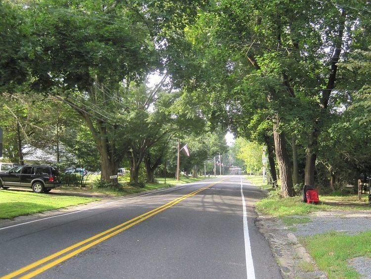
As of May 2010, the borough had a total of 8.43 miles (13.57 km) of roadways, of which 6.27 miles (10.09 km) were maintained by the municipality and 2.16 miles (3.48 km) by Monmouth County.
The only major road that passes through is CR 571 in the center of the borough.
Interstate 195 is accessible in both of its neighboring towns and Interstate 95 (the New Jersey Turnpike) is also nearby.
Notable people
People who were born in, residents of, or otherwise closely associated with Roosevelt include: