
Country United States County Monmouth Time zone Eastern (EST) (UTC-5) Elevation 3 m Zip code 07747 Area code 732 | Incorporated June 28, 1895 Area 6.224 km² Local time Tuesday 10:37 PM Population 8,755 (2013) | |
 | ||
Area rank 380th of 566 in state25th of 53 in county Weather -5°C, Wind W at 27 km/h, 65% Humidity | ||
Matawan is a borough in Monmouth County, New Jersey, United States. As of the 2010 United States Census, the borough's population was 8,810, reflecting a decline of 100 (-1.1%) from the 8,910 counted in the 2000 Census, which had in turn declined by 360 (-3.9%) from the 9,270 counted in the 1990 Census.
Contents
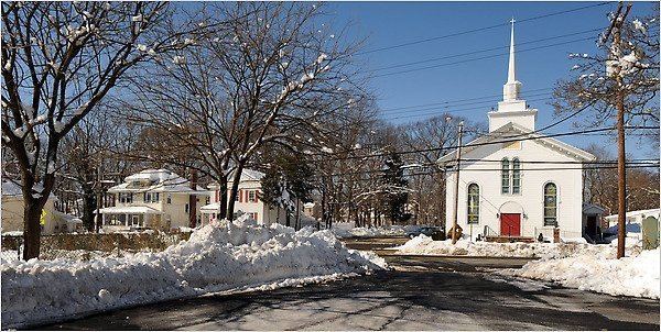
- Map of Matawan NJ 07747 USA
- History
- Geography
- Census 2010
- Census 2000
- Parks and recreation
- Local government
- Federal state and county representation
- Politics
- Education
- Roads and highways
- Public transportation
- Notable people
- Community
- References
Map of Matawan, NJ 07747, USA
Matawan is part of the Bayshore Regional Strategic Plan, an effort by nine municipalities in northern Monmouth County to reinvigorate the area's economy by emphasizing the traditional downtowns, dense residential neighborhoods, maritime history, and the natural beauty of the Raritan Bayshore coastline.
History
The Lenape Native Americans called the area "Mechananienk", a Lenape language word meaning "where two rivers come together", which gave rise to the area being called "Matovancons" by Dutch settlers, from which derives the name "Matawan". which may derive from a Lenape word meaning "where two rivers come together". It may also originate from the Southern Unami Matawonge, "bad riverbank" or "bad hill", a possible reference to bluffs along Raritan Bay which were subject to erosion and collapse prior to the construction of a seawall in the 1970s. Another possible source is Matawan, Northern Unami for "bad fog", which may have referred to fog generated on Raritan Bay. Other possible meanings are "magician", "charmed skin" or "it arrives in a lake".
The community was established by Dutch settlers in the 17th century (Matawan celebrated a tricentennial in the 1980s). Scotch-Irish settlers from New Hampshire later named the town New Aberdeen. Neighboring Matawan Township reused the historic name in the 1970s when it changed its name to Aberdeen Township.
Matawan was formed as a borough on June 28, 1895, from portions of Matawan Township (now Aberdeen Township), based on the results of a referendum held that day. Matawan expanded with portions of Matawan Township in 1931 and 1933, and from Madison Township (now Old Bridge Township) in 1939.
Despite being 11 miles (18 km) from the Atlantic Ocean, Matawan was the site of three shark attacks on July 12, 1916, in Matawan Creek, causing two deaths. They closely followed an attack in Beach Haven on July 1 and one in Spring Lake on July 6 that were all part of the Jersey Shore shark attacks of 1916.
Matawan played an important role in aviation navigation history. In 1944, the first operational Visual Aural Range (VAR) was installed at Matawan. Designed in 1937 at the Bureau of Air Commerce's research center, this system operated in the VHF band around 63 mHz and was an incremental improvement over prior aviation navigation systems such as the four-course radio range. VAR was later redeveloped into VOR.
Geography
According to the United States Census Bureau, the borough had a total area of 2.403 square miles (6.225 km2), including 2.261 square miles (5.856 km2) of land and 0.142 square miles (0.369 km2) of water (5.92%).
Unincorporated communities, localities and place names located partially or completely within the borough include Freneau and Oak Shades.
The borough borders Aberdeen Township and Marlboro Township in Monmouth County, as well as Old Bridge Township in Middlesex County. Matawan divides Aberdeen Township into two non-contiguous sections, with a small wedge-shaped exclave on the township's southwest corner separated from the rest of the township by a portion of Matawan located on the opposite side of Route 79.
Census 2010
The 2010 United States Census counted 8,810 people, 3,358 households, and 2,280 families residing in the borough. The population density was 3,896.6 per square mile (1,504.5/km2). The borough contained 3,606 housing units at an average density of 1,594.9 per square mile (615.8/km2). The racial makeup of the borough was 80.98% (7,134) White, 7.04% (620) Black or African American, 0.11% (10) Native American, 6.41% (565) Asian, 0.01% (1) Pacific Islander, 2.77% (244) from other races, and 2.68% (236) from two or more races. Hispanics or Latinos of any race were 10.77% (949) of the population.
Out of a total of 3,358 households, 32.3% had children under the age of 18 living with them, 53.0% were married couples living together, 10.6% had a female householder with no husband present, and 32.1% were non-families. 24.7% of all households were made up of individuals, and 7.7% had someone living alone who was 65 years of age or older. The average household size was 2.59 and the average family size was 3.15.
In the borough, 22.6% of the population were under the age of 18, 8.1% from 18 to 24, 29.7% from 25 to 44, 28.0% from 45 to 64, and 11.7% who were 65 years of age or older. The median age was 38.3 years. For every 100 females the census counted 94.5 males, but for 100 females at least 18 years old, it was 90.8 males.
The Census Bureau's 2006–10 American Community Survey showed that (in 2010 inflation-adjusted dollars) median household income was $68,375 (with a margin of error of +/- $7,318) and the median family income was $85,677 (+/- $6,353). Males had a median income of $57,376 (+/- $10,034) versus $42,255 (+/- $14,121) for females. The per capita income for the borough was $39,773 (+/- $5,834). About 3.5% of families and 5.2% of the population were below the poverty line, including 9.6% of those under age 18 and 5.4% of those age 65 or over.
Census 2000
As of the 2000 United States Census there were 8,910 people, 3,531 households, and 2,376 families residing in the borough. The population density was 3,909.1 people per square mile (1,508.8/km2). There were 3,640 housing units at an average density of 1,597.0 per square mile (616.4/km2). The racial makeup of the borough was 82.35% White, 6.53% African American, 0.02% Native American, 7.99% Asian, 0.02% Pacific Islander, 1.23% from other races, and 1.85% from two or more races. Hispanic or Latino of any race were 6.45% of the population.
There were 3,531 households out of which 30.2% had children under the age of 18 living with them, 54.3% were married couples living together, 9.1% had a female householder with no husband present, and 32.7% were non-families. 25.6% of all households were made up of individuals and 7.8% had someone living alone who was 65 years of age or older. The average household size was 2.52 and the average family size was 3.07.
In the borough the population was spread out with 22.6% under the age of 18, 7.3% from 18 to 24, 36.4% from 25 to 44, 23.3% from 45 to 64, and 10.5% who were 65 years of age or older. The median age was 36 years. For every 100 females there were 97.6 males. For every 100 females age 18 and over, there were 95.8 males.
The median income for a household in the borough was $63,594, and the median income for a family was $72,183. Males had a median income of $51,924 versus $37,113 for females. The per capita income for the borough was $30,320. About 3.8% of families and 5.4% of the population were below the poverty line, including 6.9% of those under age 18 and 7.3% of those age 65 or over.
Parks and recreation
Matawan is the northern terminus of the middle segment of the Henry Hudson Trail, and the western terminus of the eastern section.
Local government
Matawan is governed under the Borough form of New Jersey municipal government. The governing body consists of a Mayor and a Borough Council comprising six council members, with all positions elected at-large on a partisan basis as part of the November general election. A Mayor is elected directly by the voters to a four-year term of office. The Borough Council consists of six members elected to serve three-year terms on a staggered basis, with two seats coming up for election each year in a three-year cycle. The Borough form of government used by Matawan, the most common system used in the state, is a "weak mayor / strong council" government in which council members act as the legislative body with the mayor presiding at meetings and voting only in the event of a tie. The mayor can veto ordinances subject to an override by a two-thirds majority vote of the council. The mayor makes committee and liaison assignments for council members, and most appointments are made by the mayor with the advice and consent of the council.
As of 2016, the Mayor of Matawan is Democrat Joseph Altomonte whose term of office ends December 31, 2019. Members of the Matawan Borough Council are Council President Joseph Urbano (R, 2017), Michael Caldon (R, 2017), Linda Clifton (R, 2016), Donna Gould (R, 2016), Nicolas Reeve (D, 2018) and Michael Vergaretti (D, 2018).
In May 2015, Councilmember Toni Marie Angelini announced that she would be resigning from office at the end of June as she was relocating to Wall Township.
After the general election vote for mayor in November 2007 ended in a tie, a special runoff election was held in January 2008, in which Republican Paul Buccellato took 51% of the vote and defeated the incumbent, Democrat Mary Aufseeser, who had just short of 49%.
Federal, state and county representation
Matawan is located in the 6th Congressional District and is part of New Jersey's 12th state legislative district. Prior to the 2011 reapportionment following the 2010 Census, Matawan had been in the 13th state legislative district.
New Jersey's Sixth Congressional District is represented by Frank Pallone (D, Long Branch). New Jersey is represented in the United States Senate by Cory Booker (D, Newark, term ends 2021) and Bob Menendez (D, Paramus, 2019).
For the 2016–2017 session (Senate, General Assembly), the 12th Legislative District of the New Jersey Legislature is represented in the State Senate by Samuel D. Thompson (R, Old Bridge Township) and in the General Assembly by Robert D. Clifton (R, Matawan) and Ronald S. Dancer (R, Plumsted Township). The Governor of New Jersey is Chris Christie (R, Mendham Township). The Lieutenant Governor of New Jersey is Kim Guadagno (R, Monmouth Beach).
Monmouth County is governed by a Board of Chosen Freeholders consisting of five members who are elected at-large to serve three year terms of office on a staggered basis, with either one or two seats up for election each year as part of the November general election. At an annual reorganization meeting held in the beginning of January, the board selects one of its members to serve as Director and another as Deputy Director. As of 2014, Monmouth County's Freeholders are Freeholder Director Lillian G. Burry (R, Colts Neck Township; term ends December 31, 2014), Freeholder Deputy Director Gary J. Rich, Sr. (R, Spring Lake; 2014), Thomas A. Arnone (R, Neptune City; 2016), John P. Curley (R, Middletown Township; 2015) and Serena DiMaso (R, Holmdel Township; 2016). Constitutional officers elected on a countywide basis are County Clerk M. Claire French (Wall Township), Sheriff Shaun Golden (Farmingdale) and Surrogate Rosemarie D. Peters (Middletown Township).
Politics
As of March 23, 2011, there were a total of 5,315 registered voters in Matawan, of which 1,355 (25.5%) were registered as Democrats, 1,136 (21.4%) were registered as Republicans and 2,820 (53.1%) were registered as Unaffiliated. There were 4 voters registered to other parties.
In the 2012 presidential election, Democrat Barack Obama received 52.1% of the vote (1,937 cast), ahead of Republican Mitt Romney with 46.6% (1,732 votes), and other candidates with 1.3% (50 votes), among the 3,753 ballots cast by the borough's 5,667 registered voters (34 ballots were spoiled), for a turnout of 66.2%. In the 2008 presidential election, Democrat Barack Obama received 49.9% of the vote (2,090 cast), ahead of Republican John McCain with 47.3% (1,983 votes) and other candidates with 1.4% (57 votes), among the 4,188 ballots cast by the borough's 5,604 registered voters, for a turnout of 74.7%. In the 2004 presidential election, Republican George W. Bush received 52.3% of the vote (2,081 ballots cast), outpolling Democrat John Kerry with 47.3% (1,880 votes) and other candidates with 0.5% (29 votes), among the 3,978 ballots cast by the borough's 5,440 registered voters, for a turnout percentage of 73.1.
In the 2013 gubernatorial election, Republican Chris Christie received 68.2% of the vote (1,638 cast), ahead of Democrat Barbara Buono with 30.3% (727 votes), and other candidates with 1.5% (37 votes), among the 2,432 ballots cast by the borough's 5,678 registered voters (30 ballots were spoiled), for a turnout of 42.8%. In the 2009 gubernatorial election, Republican Chris Christie received 58.0% of the vote (1,639 ballots cast), ahead of Democrat Jon Corzine with 32.5% (920 votes), Independent Chris Daggett with 7.5% (213 votes) and other candidates with 1.2% (35 votes), among the 2,827 ballots cast by the borough's 5,377 registered voters, yielding a 52.6% turnout.
Education
Matawan is part of the Matawan-Aberdeen Regional School District (MARSD), which also serves students from the neighboring community of Aberdeen Township. As of the 2011-12 school year, the district's seven schools had an enrollment of 3,871 students and 307.0 classroom teachers (on an FTE basis), for a student–teacher ratio of 12.61:1. Schools in the district (with 2011-12 enrollment data from the National Center for Education Statistics) are Cambridge Park Developmental Learning Center (Preschool; 96 students), Cliffwood Elementary School (K-3; 336), Ravine Drive Elementary School (K-3; 390), Strathmore Elementary School (K-3; 512), Lloyd Road Elementary School (4-5; 591), Matawan Aberdeen Middle School (6 - 8; 847) and Matawan Regional High School (9 - 12; 1,099).
Roads and highways
As of May 2010, the borough had a total of 31.45 miles (50.61 km) of roadways, of which 24.37 miles (39.22 km) were maintained by the municipality, 4.50 miles (7.24 km) by Monmouth County and 2.50 miles (4.02 km) by the New Jersey Department of Transportation.
Matawan is traversed by Route 34, Route 79 and County Route 516. The Garden State Parkway skirts the northern end of the borough (with the southbound lanes only passing through briefly); the nearest exits are exits 117A and 120.
Public transportation
In the late 20th century, Matawan became known for its heavily used train station at Aberdeen-Matawan on NJ Transit's North Jersey Coast Line, which attracts riders from all over western Monmouth County and provides service to New York City's Penn Station, either directly or via Secaucus Junction.
NJ Transit also provides bus service to the Port Authority Bus Terminal in Midtown Manhattan on the 133 and 135 bus lines.
Notable people
People who were born in, residents of, or otherwise closely associated with Matawan include:
Community
Matawan was ranked by BusinessWeek magazine at #12 in the nation on their list of "The 50 Best Places to Raise Your Kids" in November 2007.