
County Rockland FIPS code 36-48010 Elevation 167 m Area code Area code 845 | State New York Time zone Eastern (EST) (UTC-5) GNIS feature ID 0957535 Zip code 10952 Population 18,412 (2010) | |
 | ||
Area 5.8 km² (5.7 km² Land / 10 ha Water) | ||
Monsey is a hamlet and census-designated place, in the town of Ramapo, Rockland County, New York, United States, located north of Airmont; east of Viola; south of New Hempstead; and west of Spring Valley. The village of Kaser is completely surrounded by the hamlet of Monsey. The 2010 census listed the population at 18,412.
Contents
Map of Monsey, NY, USA
The hamlet has a large community of Orthodox Jews, consisting predominantly of Hasidim, including Vizhnitz hasidim who reside mostly in the village of Kaser.
History
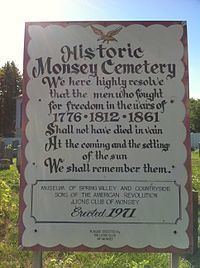
Rockland County was inhabited by the Munsee band of Lenape Native Americans, who were speakers of the Algonquian languages. Monsey Glen, an Indian encampment, is located west of the intersection of State Route 59 and State Route 306. Numerous artifacts have been found there and some rock shelters are still visible. The Monsey railroad station, which received its name from an alternate spelling of the Munsee Lenape, was built when the New York & Erie Railroad passed through the glen in 1841.
In the 1950s, Monsey was a one stoplight town with a single yeshiva. By 1997, Monsey had 112 synagogues and 45 yeshivas.
Located near Monsey is the Houser-Conklin House, listed on the National Register of Historic Places in 2010.
See Also Ramapo people
Geography
Monsey is located at 41°7′10″N 74°3′57″W .
According to the United States Census Bureau, the CDP has a total area of 2.2 square miles (5.8 km2), of which, 2.2 square miles (5.7 km2) of it is land and 0.04 square miles (0.1 km2) of it (0.90%) is water.
Demographics
As of the census of 2000, there were 14,504 people, 2,981 households, and 2,596 families residing in the CDP. The population density was 6,554.3 per square mile (2,533.9/km2). There were 3,098 housing units at an average density of 1,400.0/sq mi (541.2/km2). The racial makeup of the CDP was 92.82% White, 4.32% African American, 0.03% Native American, 1.05% Asian, 0.01% Pacific Islander, 0.70% from other races, and 1.08% from two or more races. Hispanic or Latino of any race were 2.86% of the population. 43.98% speak English at home, 41.48% Yiddish, 6.88% Hebrew, 2.69% French or a French creole, 1.85% Spanish, and 1.24% Russian.
There were 2,981 households out of which 58.9% had children under the age of 18 living with them, 78.0% were married couples living together, 6.0% had a female householder with no husband present, and 12.9% were non-families. 10.6% of all households were made up of individuals and 4.4% had someone living alone who was 65 years of age or older. The average household size was 4.74 and the average family size was 5.16. In the CDP, the population was spread out with 48.6% under the age of 18, 10.5% from 18 to 24, 18.2% from 25 to 44, 16.3% from 45 to 64, and 6.4% who were 65 years of age or older. The median age was 19 years. For every 100 females there were 106.8 males. For every 100 females age 18 and over, there were 106.6 males. The median income for a household in the CDP was $45,194, and the median income for a family was $45,911. Males had a median income of $41,606 versus $33,576 for females. The per capita income for the CDP was $14,000. About 25.4% of families and 30.6% of the population were below the poverty line, including 37.8% of those under age 18 and 9.2% of those age 65 or over.