
OS grid reference SJ945905 Postcode district SK6 | Sovereign state United Kingdom Dialling code 0161 | |
 | ||
Post town | ||
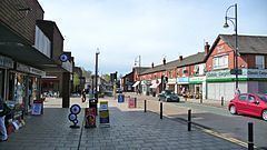
Romiley road rage reg mf57axo 4 10 2016
Romiley is an area of the Metropolitan Borough of Stockport, Greater Manchester, England. Historically part of Cheshire, it borders Marple, Bredbury and Woodley. In Roman times there is thought to have been a settlement along Sandy Lane. In the 2001 census Romiley ward, which included Compstall, Bredbury Green and a large part of Bredbury, had a population of 13,703. In the 2011 Census the population of the ward had increased to 14,139.
Contents
- Romiley road rage reg mf57axo 4 10 2016
- Map of Romiley UK
- Alex white golf santa s helpers visit romiley g c
- History
- Geography
- Transport
- Conservation areas
- References
Map of Romiley, UK
Alex white golf santa s helpers visit romiley g c
History
For centuries it was an agricultural area, until the late Victorian era, when it became a residential area, with a small district centre. There are four main schools: Romiley Primary School, Bredbury Green Primary, St Christopher's Catholic Primary School and Greave Primary School, which is on the border with Woodley. Secondary education is provided by Werneth School and Harrytown Catholic High School. Romiley also has its own theatre, the Romiley Forum.
Geography
The surrounds are quite rural, although it is a suburb. There are fields to the north, and Compstall, between Romiley and Marple, is home to the Etherow Country Park the largest country park in Stockport.
Transport
It is served by Romiley railway station on the Hope Valley Line from Sheffield to Manchester.
Conservation areas
Romiley contains four conservation areas, a designation made by the local council to protect locations which have special architectural or historical character. It helps reduce traffic, preserve wildlife and important landscapes, and restricts making changes which affect the look of the area such as changing front doors, roofing, facades or windows. They are:
A further conservation area adjoins Romiley at Hatherlow in Bredbury.