
Existed: 1937 – present Constructed 1937 | Length 654 km | |
 | ||
East end: Rua Reação in Butantã, São Paulo, SP | ||
Ccr via oeste rodovia raposo tavares
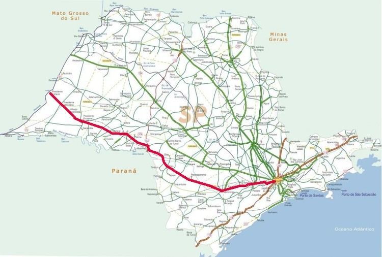
Rodovia Raposo Tavares (official designation SP-270) is the longest highway in the state of São Paulo, Brazil, with 654 km.
Contents
- Ccr via oeste rodovia raposo tavares
- Map of SP 270 SC3A3o Paulo Brazil
- Rodovia raposo tavares cotia sp kawasaki er6n hardman
- References
Map of SP-270, S%C3%A3o Paulo, Brazil
The highway starts in the city of São Paulo and continues westward, serving the main cities of Cotia, Vargem Grande Paulista, São Roque, Sorocaba, Itapetininga, Angatuba, Ourinhos, Assis, Presidente Prudente, Presidente Bernardes, Presidente Venceslau and Presidente Epitácio, at the shores of the Paraná River, by the border with Mato Grosso do Sul. It receives the Castelo Branco Highway at Ourinhos. The highway was named in honour of António Raposo Tavares, one of the leading bandeirantes (explorers of the backlands in the 16th and 17th centuries). It is managed and maintained in its first 120 km by a state concession to private company ViaOeste, and this section requires a toll. The remainder of the highway is maintained by the State of São Paulo's Department of Roads (DER).