
Time zone UTC-3 (UTC-3) Elevation 853 m Local time Tuesday 12:07 AM | Founded April 2, 1856 HDI (2000) 0.826 – high Population 170,507 (2010) University Mario Schenberg Faculty | |
 | ||
Weather 21°C, Wind SE at 8 km/h, 89% Humidity | ||
Ct cotia do s o paulo gazeta esportiva 26 12 16
Cotia is a municipality in the state of São Paulo in Brazil. It is part of the Metropolitan Region of São Paulo. The population is 229,548 (2015 est.) in an area of 323.99 km². The city is at an altitude of 853 m. Cotia is linked with the Rodovia Raposo Tavares highway.
Contents
- Ct cotia do s o paulo gazeta esportiva 26 12 16
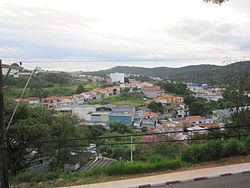
- Map of Cotia Caucaia do Alto Cotia State of SC3A3o Paulo Brazil
- Cotia na ceva de milho 4
- History
- Geography
- References
Map of Cotia - Caucaia do Alto, Cotia - State of S%C3%A3o Paulo, Brazil
Cotia na ceva de milho 4
History
Cotia was founded in 1580, and was an active village during the "bandeiras" expeditions. In 1626, Raposo Tavares and his companions arrived in the city. The "Sítio do Mandú" and "Sítio do Padre Inácio" (Mandu's Ranch and Priest Inácio's Ranch) were some of the first rural houses to be built there. Nowadays, they are preserved by the "Instituto Brasileiro de Patrimônio Cultural. Cotia was declared an independent municipality on April 2, 1856. According to the 1980 demographic census, the city had a population of over 62 thousand people.
Geography
The city is located west of São Paulo, and has a terrain made of valleys and mountains, reaching a maximum altitude of 1,074 meters above sea level
The city has the Cotia River as its main river.
The city has a densely populated urban area, but the less developed areas to the west attract people interested in ecotourism.