
Status in service No. of stations 1 Number of stations 1 | End Sunset Hills Mortuary Line length 4,715 m Character Public transport | |
 | ||
Location Tualatin Mountains, Portland, Oregon, United States | ||
Robertson tunnel
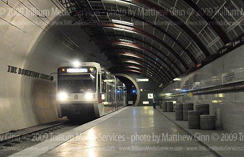
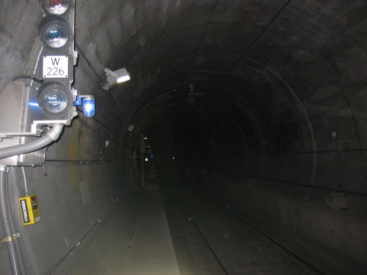
The Robertson Tunnel is a twin-bore light rail tunnel through the Tualatin Mountains west of Portland, Oregon, United States, used by the MAX Blue and Red Lines. The tunnel is 2.9 miles (4.7 kilometers) long and consists of twin 21-foot-diameter (6.4 m) tunnels. There is one station within the tunnel at Washington Park, which at 259 feet (79 m) deep is the deepest subway station in the United States and the fifth-deepest in the world. Trains are in the tunnel for about 5 minutes, which includes a stop at the Washington Park station. The tunnel has won several worldwide engineering and environmental awards. It was placed into service September 12, 1998.
Contents
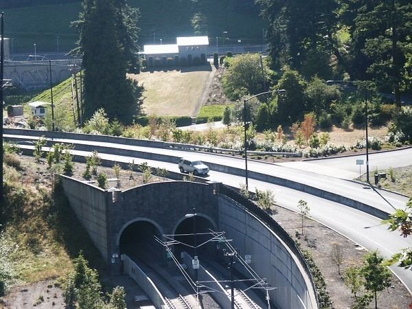
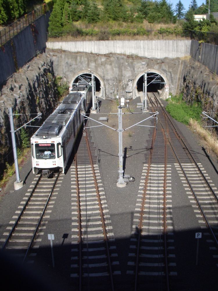
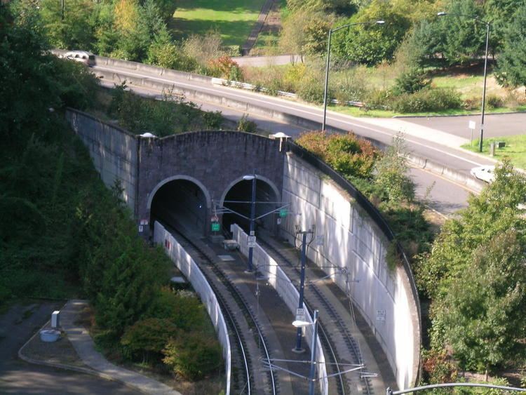
The tunnels pass through basalt layers up to 16 million years old. Due to variations in the rock composition, the tunnel curves mildly side to side and up and down to follow the best rock construction conditions. The tunnels vary from 80 to 300 feet (24–91 m) below the surface. A core sample taken during construction is on display with a timeline of local geologic history. The east tunnel entrance is near Vista Bridge at the edge of the Goose Hollow neighborhood at the foot of Washington Park. The west entrance is along U.S. Highway 26 just west of the Finley-Sunset Hills cemetery, about a mile east of the junction with Oregon Highway 217.
Robertson tunnel train arriving
Name
The tunnel is named for William D. Robertson, who served on the TriMet board of directors and was its president at the time of his death.
History
Originally, it was expected that the westside MAX line would be adjacent to the Sunset Highway, despite the six percent average grade. Reliability, weather conditions, public opinion, and environmental concerns led to choosing to tunnel through the Tualatin Mountains instead.
Construction began in the summer of 1993 at the west end, employing the conventional mining technique of drilling and blasting due to the loose mixture of materials. More than 75 tons of explosives were used and mining progressed about a mile into the hill. East end construction began in August 1994 with a customized tunnel boring machine. About a thousand workers from 230 construction firms were involved in the 18-mile westside MAX line, including those who built the tunnel and installed the reinforced concrete liner, tracks and wiring. One worker was killed while operating equipment.
Tunnel construction continued 24 hours a day, six days per week. The north tunnelers met after 16 months on December 29, 1995, and the boring machine began the south tunnel in April 1996. Work in the south tunnel took only four months before the tunneling teams met on August 15, 1996.
To complete the west end at the cemetery, 14 bodies were relocated.
The original estimate for the tunnel was $103.7 million, but the final price tag came to $184 million, largely due to challenges posed by unexpected loose layers of silt and gravel, and crumbling basalt which prevented the boring machine from working effectively.
Route
The tunnel generally follows – but remains north of – U.S. Highway 26, diverging the most (1⁄3 mile (540 meters)) in the Oregon Zoo area.
The elevation at the west end is higher than the east but there is very little perceptible slope except for several gentle, short grades which exist presumably to follow the easiest-to-bore rock stratum.
During construction, the east portal was west of Canyon Road, below City of Portland Reservoir 4. After completion, the road was raised and an overpass placed over the track. This effectively extended the original bored-and-blasted tunnel east by about 430 feet (130 m), making the final length 2.93 miles (4.71 km), so that it would emerge to the east of Canyon Road, and on the south side of Jefferson Street (immediately east of where Canyon Road bends from north to east and becomes Jefferson Street).
Beginning at the east end (traveling westward), under Canyon Road the tunnel turns SSW (202°) for about 300 m (980 ft) where it turns WSW (236°) under the large field east of the Elephant House. Twelve hundred meters (4000 ft) later it is directly under and follows SW Kingston Road at a point 250 m (820 ft) north of the zoo's elephant exhibit. For the next 250 m (820 ft), it arcs until almost directly westward (263°) and straightens for 300 m (980 ft) to arrive at Washington Park.
After the station, it passes under the south side of the World Forestry Center's main building and turns 4° northward (267°) and continues for its longest straight stretch of 900 meters (3,000 ft). At the point it passes under SW Skyline Road 150 meters (490 ft) north of the Sylvan Bridge, it turns slightly southward (253°) and—300 m (980 ft) later—goes under the Finley-Sunset Hills building and water feature. For the remaining 500 m (1,600 ft)), it turns right in a long gradual arc exactly paralleling Sunset Hwy. The arc continues at the same rate after the west portals, and is due west (270°) about 500 m (1,600 ft) past the portals.