
Type light rail Website MAX Red Line Line length 41,038 m Operator TriMet | System MAX Light Rail Opened September 10, 2001 Locale Portland Stations 29 | |
 | ||
Track gauge 1,435 mm (4 ft 8 ⁄2 in) standard gauge Electrification 750 V DC, overhead catenary Terminis Portland International Airport MAX Station, Beaverton Transit Center | ||
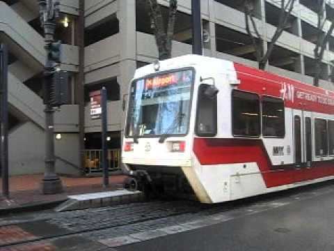
The MAX Red Line is a light rail line in the Metropolitan Area Express system in the Portland, Oregon metropolitan area. It is 25.5 miles (41 km) long. The route, operated by TriMet, provides an airport rail link to Portland International Airport from Beaverton and downtown Portland.
Contents
History
When Portland International Airport was suffering from heavy road traffic coming from increased passenger service, and the Port of Portland was running out of land for new parking lots, the Port approached TriMet about bringing MAX to the airport, following through on a plan that dated to highway construction in the 1970s which had left room for such a connection.
The Airport MAX project was born, but the line was delayed after a North-South light rail proposal, part of which is today's MAX Yellow Line, was defeated at the polls. Instead, the Port and TriMet built the project through a public–private partnership with the Bechtel Corporation. Bechtel agreed to pay for a large portion of the land cost of the line in exchange for rights to the planned Cascades development on empty land that the Port of Portland owned near I-205 and the Airport. Construction started in spring 1999.
The line opened on September 10, 2001, one day before the September 11, 2001 attacks, which had the side effect of shutting down all air travel in the United States for almost three days. Planned opening ceremonies for the line were cancelled as a result of the attacks.
The section that involved new construction, between the Gateway Transit Center and the airport, is 5.6 miles (9.0 km) long. Between Gateway and downtown Portland, the new line used the previously opened tracks and stations of the Eastside MAX line. Red Line service terminated in downtown (Galleria/SW 10th Avenue station) for its first two years of operation.
For much of its length, the new section follows the I-205 freeway. That section of the freeway was completed in the early 1980s, and local planners had included space within the overall right-of-way for a future transitway, which, at the time, was expected to be a busway; TriMet had not even begun building its first light rail line at that time. This foresight allowed the Airport light rail line to be built at lower costs than might otherwise have been the case, as most of the needed right-of-way was already in public hands. Between the Gateway and Parkrose/Sumner TC stations the tracks pass through a short tunnel, taking them from the east bank of the freeway to the median. The tunnel had been built some 20 years earlier, during the freeway's construction. Had it needed to be built later, it would have been much more costly and lengthened the MAX project's construction time.
Extensions
In September 2003, Red Line service was extended farther west along the existing Blue Line tracks, from downtown to the Beaverton Transit Center, to increase capacity between the Gateway area and Beaverton and also to provide a no-transfer airport connection for Westside MAX riders.
Starting in March 2008, three trips in each direction, in each rush hour, were extended west of Beaverton TC, to/from the Hillsboro terminus, Hatfield Government Center station. The reason for this change was to provide additional capacity on that section of the Blue Line, whose ridership was continuing to grow. TriMet still defines the MAX Red Line as being Airport–City Center–Beaverton TC. Those few trips which operate through all the way from the airport to Hillsboro, and vice versa, are marked in printed public schedules as "blue" trips (shaded in blue) on their Blue Line portions, and the MAX cars display blue signs over most of the trip.