
- elevation 12,490 ft (3,807 m) Length 113 km Bridges Sheely Bridge | - elevation 5,718 ft (1,743 m) | |
 | ||
Similar Independence Pass, Snowmass, Aspen Mountain, Mount Sopris, Rocky Mountains | ||
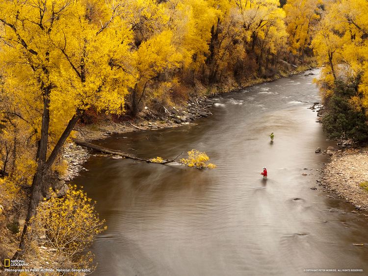
Fly fishing on colorado s roaring fork river
Roaring Fork River is a tributary of the Colorado River, approximately 70 miles (110 km) long, in west central Colorado in the United States. The river drains a populated and economically vital area of the Colorado Western Slope called the Roaring Fork Valley or Roaring Fork Watershed, which includes the resort city of Aspen and the resorts of Aspen/Snowmass.
Contents
- Fly fishing on colorado s roaring fork river
- Map of Roaring Fork River Colorado USA
- Fly fish glenwood roaring fork river colorado river
- References
Map of Roaring Fork River, Colorado, USA
It rises in the Sawatch Range in eastern Pitkin County, on the west side of Independence Pass on the continental divide. It flows northwest past Aspen, Woody Creek, and Snowmass. It receives the Fryingpan River at Basalt. 1.5 miles (2 km) below Carbondale, it receives the Crystal River from the south. It joins the Colorado in Glenwood Springs. The entire area that drains into the Roaring Fork River is known as the Roaring Fork Watershed. This area is 1,451 square miles (3,760 km2) and about the same size as the state of Rhode Island. The river flows through canyons along most of its route and is a popular destination for recreation whitewater rafting. The river supplies water through the Sawatch Range to the Twin Lakes Reservoir via the Twin Lakes Tunnel. Roaring Fork Conservancy is the watershed conservation organization for the Roaring Fork River and its tributaries.
The Roaring Fork is a swift, deep, powerful river with very clear water. It is navigable by small craft throughout most of its length to its confluence with the Colorado. The mean annual flow is 1,206 cu ft/s (34.2 m3/s).