
Max depth 16 m Max width 4,000 m | Basin countries Australia Settlements BeachportSouthend Length 11,500 m | |
 | ||
Max. length 11.5 kilometres (7.1 mi). | ||
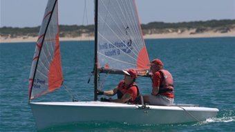
Rivoli bay tasar challenge 2012
Rivoli Bay, (French: Baie de Rivoli) is a bay located on the south-east coast of South Australia about 65 kilometres (40 mi) northwest by west of Mount Gambier and about 311 kilometres (193 mi) south-southeast of Adelaide. It was named in 1802 by the Baudin expedition of 1800-03 after André Masséna, the Duke of Rivoli and Marshal of France. It is one of four ‘historic bays’ located on the South Australian coast.
Contents
- Rivoli bay tasar challenge 2012
- Map of Rivoli Bay South Australia Australia
- Extent description
- European discovery
- Ports and other settlements
- Protected areas
- References
Map of Rivoli Bay, South Australia, Australia
Extent & description
Rivoli Bay lies between Cape Martin at its northern extremity and Cape Buffon at its southern extremity on the south-east coast of South Australia. The bay is described as its ‘central part … is obstructed by numerous reefs, rocky patches, and shoals and is dangerous for navigation’ and as having ‘a sandy beach’ that ‘forms the shore of the bay between Glen Point (sic) and the promontory of Cape Buffon, at the S(outh) end of the bay’. Glenns Point is the point immediately north-east of Cape Martin on the bay’s northern headland. A small island named Penguin Island of 16 metres (52 ft) height is located immediately adjacent to Cape Martin. Rivoli Bay is one of four bays on the South Australian coast considered by the Australian government to be a ‘historic bay’ under the Seas and Submerged Lands Act 1973 and was proclaimed as such in 1987 and again in 2006 with the result that the mouth of the bay is on the territorial seas baseline and the waters within the bay are internal waters as per the definition used in United Nations Convention on the Law of the Sea. Navigation aids are located at both ends of the bay with a lighthouse on the north headland near Cape Martin and a light on the south headland at Cape Buffon.
European discovery
Rivoli Bay was named in 1802 by Peron and Freycinet of the Baudin expedition of 1800-03 after André Masséna, the Duke of Rivoli and Marshal of France.
Ports and other settlements
The following two settlements are located on its shores: Beachport and Southend. Both settlements have port infrastructure consisting of jetties.
Protected areas
The following protected areas adjoin the bay’s extent: the Canunda National Park and the Penguin Island Conservation Park.