
- left Little River - elevation 400 m (1,312 ft) Length 11 km | - right Sherdon Water | |
Bridges Tarr Steps, Landacre Bridge, Barle Bridge | ||
Teignbridge canoe club river barle 15th nov 2015
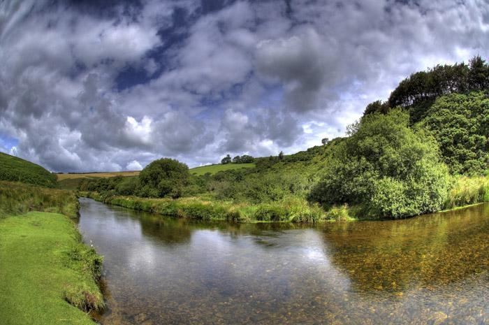
The River Barle runs from the Chains on northern Exmoor, in Somerset, England to join the River Exe at Exebridge, Devon. The river and the Barle Valley are both designated as biological Site of Special Scientific Interest.
Contents
- Teignbridge canoe club river barle 15th nov 2015
- River barle running the weir below dulverton
- EcologyEdit
- AnglingEdit
- WalkingEdit
- Kayaking and canoeingEdit
- References
On the Chains above Simonsbath is a 3 acres (1.2 ha) reservoir known as Pinkery Pond. It was formed by damming the River Barle, in the 19th century by John Knight and his son, and was originally intended to be 7 acres (2.8 ha). The purpose is unknown but close to the pond is the remains of a small canal. Wheal Eliza Mine was an unsuccessful copper and iron mine on the river near Simonsbath.
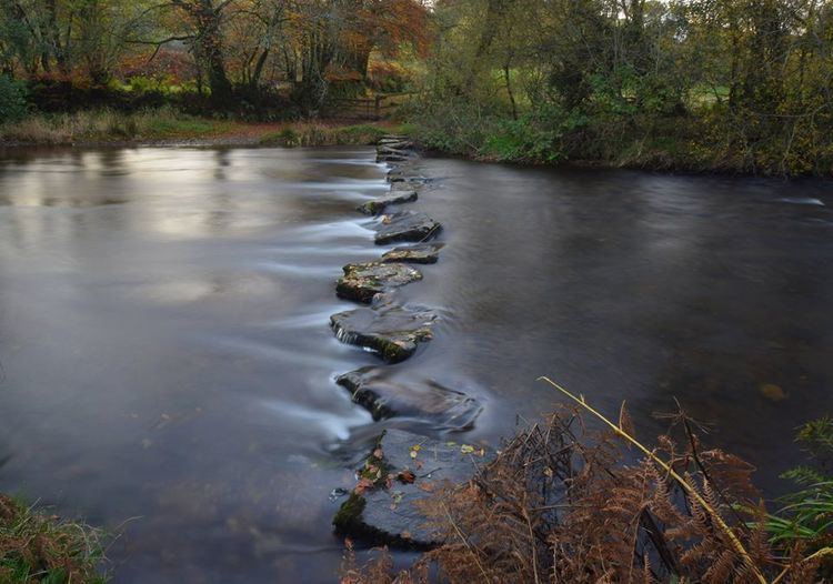
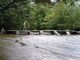
The river passes under a late medieval six arch stone Landacre Bridge in Withypool, and the Tarr Steps a prehistoric clapper bridge possibly dating from 1000 BC. The stone slabs weigh up to 5 tons apiece. According to local legend, they were placed by the devil to win a bet. The bridge is 180 feet (55 m) long and has 17 spans. It has been designated by English Heritage as a grade I listed building. In Dulverton the river is crossed by the Barle Bridge.
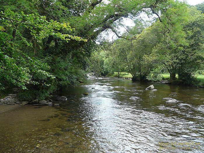
River barle running the weir below dulverton
EcologyEdit
The river flows through the Somerset Wildlife Trust's Mounsey Wood Nature Reserve and Knaplock and North Barton SSSI notified in 1954. The site is within Exmoor National Park.
The Barle Valley contains extensive tracts of ancient upland sessile oak ancient woodland which exhibit variations in structure and species composition as a result of difference in past management, geology and topography. The diversity of the site is increased substantially by areas of valley mire, heathland and acid grassland. Eighty five woodland vascular plant species have been recorded including thirty one ancient woodland indicators from a single compartment. The meadows are one of the few sites for great burnet on Exmoor. Springs emerging from the base of sandstone slopes generate nutrient poor acid mires dominated by Sphagnum and Polytrichum moss carpets. The lichen flora is exceptional both for its luxuriance and in the number of rare species. One hundred and sixty five taxa of epiphytic lichens are present containing a remarkably large proportion of ancient woodland indicators giving the Barle a very high index of ecological continuity. The site contains an outstanding assemblage of woodland breeding birds including particularly high densities of wood warbler, redstart and pied flycatcher. The River Barle provides an important habitat for kingfisher, dipper and grey wagtail, while scrub and heath have breeding stonechat and whinchat. Twenty species of butterfly have been recorded in the valley including the nationally scarce marsh fritillary and nationally vulnerable high brown fritillary. Both roe deer and red deer graze areas of wood pasture. The presence of otters on the Barle has been regularly recorded. A colony of dormice inhabits at least one of the hazel coppices.
AnglingEdit
Salmon and trout are regularly fished from the Barle.
WalkingEdit
For much of its route the river's banks are the path of the Two Moors Way footpath.
Kayaking and canoeingEdit
The upper reaches of the Barle produced favourable rapids which appeal to whitewater kayakers. The rapids are Graded at 2 (3-) which beginner to intermediate kayakers and canoeists paddle.