
Country United States County Berkshire Incorporated 1765 Elevation 322 m Population 1,475 (2010) | Settled 1760 Time zone Eastern (UTC-5) Zip code 01254 Local time Wednesday 9:42 PM | |
 | ||
Weather 2°C, Wind NW at 16 km/h, 51% Humidity | ||
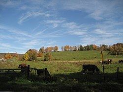
Richmond iron works riw richmond massachusetts usa
Richmond is a town in Berkshire County, Massachusetts, United States. It is part of the Pittsfield, Massachusetts Metropolitan Statistical Area. The population was 1,475 at the 2010 census.
Contents
- Richmond iron works riw richmond massachusetts usa
- Map of Richmond MA USA
- History
- Geography
- Demographics
- Government
- Education
- Notable people
- References
Map of Richmond, MA, USA
History
The area around Richmond was settled as part of the town of Stockbridge in 1756. The town was set apart and incorporated in 1765, and named for Charles Lennox, Duke of Richmond. The town of Lenox, which grew out of the village of Yokuntown, was also named for him when it was incorporated two years later. The town was mostly agrarian until the discovery of iron ore in 1829, which led to an iron works which lasted into the twentieth century.
Geography
According to the United States Census Bureau, the town has a total area of 19.0 square miles (49.2 km2), of which 18.7 square miles (48.4 km2) is land and 0.31 square miles (0.8 km2), or 1.71%, is water.
Richmond is bordered on the north by Hancock and Pittsfield, on the east by Lenox, on the south by Stockbridge and West Stockbridge, and on the west by Canaan, Columbia County, New York.
Massachusetts Route 41 passes from north to south through the town, and Route 295, the state's highest-numbered state route, continues from Route 41 to the corresponding New York state route. The nearest interstate is Interstate 90, also known as the Massachusetts Turnpike. Exit 1 is located two miles further south along Route 41, but only allows for westbound exit and eastbound entrance. The nearest westbound entrance to the interstate is in Canaan, at the Berkshire Spur (Connector) portion of the New York State Thruway, Exit B3. The nearest municipal airport is Pittsfield Municipal Airport, 5.5 miles (8.9 km) away, and the nearest airport serving national flights is Albany International Airport, 45 miles (72 km) northwest of the town. There is no bus service in town, and the nearest bus station is in Pittsfield. There is also a CSX freight rail line which passes through the town.
Demographics
As of the census of 2000, there were 1,604 people, 643 households, and 480 families residing in the town. The town ranks 16th out of the 32 towns in Berkshire County, and 304th out of 351 in the Commonwealth by population.The population density was 84.6 people per square mile (32.7/km²), placing it 14th in the county and 293rd in the Commonwealth. There were 833 housing units at an average density of 43.9 per square mile (17.0/km²). The racial makeup of the town was 97.63% White, 1.00% African American, 0.50% Native American, 0.44% Asian, 0.06% Pacific Islander, 0.37% from other races. Hispanic or Latino of any race were 0.56% of the population.
There were 643 households out of which 27.7% had children under the age of 18 living with them, 64.4% were married couples living together, 8.2% had a female householder with no husband present, and 25.2% were non-families. 20.8% of all households were made up of individuals and 9.5% had someone living alone who was 65 years of age or older. The average household size was 2.49 and the average family size was 2.89.
In the town, the population was spread out with 21.5% under the age of 18, 4.9% from 18 to 24, 22.9% from 25 to 44, 35.0% from 45 to 64, and 15.7% who were 65 years of age or older. The median age was 45 years. For every 100 females there were 96.8 males. For every 100 females age 18 and over, there were 92.2 males.
The median income for a household in the town was $60,917, and the median income for a family was $72,500. Males had a median income of $45,536 versus $36,250 for females. The per capita income for the town was $35,568. About 1.9% of families and 3.1% of the population were below the poverty line, including 0.9% of those under age 18 and 3.2% of those age 65 or over.
Government
Richmond is governed by the open town meeting form of government, and is governed by a board of selectmen. The town has its own police department and a volunteer fire department. The town has its own library and other public services.
On the state level, Richmond is represented in the Massachusetts House of Representatives as part of the Second Berkshire district, represented by Paul Mark, which covers central Berkshire County, as well as portions of Hampshire and Franklin counties. In the Massachusetts Senate, the town is part of the Berkshire, Hampshire and Franklin district, represented by Ben Downing, which includes all of Berkshire County and western Hampshire and Franklin counties. The town is patrolled by the First (Lee) Station of Barracks "B" of the Massachusetts State Police.
On the national level, Richmond is represented in the United States House of Representatives as part of Massachusetts's 1st congressional district, and has been represented by John Olver of Amherst from June 1991 to 2013 when Olver retired and redistricting put Richard Neal in the 1st district. Massachusetts is currently represented in the United States Senate by Elizabeth Warren and Ed Markey.
Education
Richmond has one school, Richmond Consolidated School, which serves students in town from preschool through 8th grades. Richmond has an arrangement to send its high school students to Pittsfield High School, Monument Mountain Regional High School, or Taconic High School. Private schools are located in Pittsfield as well.
The nearest community college, Berkshire Community College, is in Pittsfield. The nearest state college is Massachusetts College of Liberal Arts, and the nearest university is the University of Massachusetts Amherst.