
Country United States GNIS feature ID 453792 Local time Wednesday 8:24 PM | FIPS code 18-64044 Elevation 257 m Population 1,181 (2010) | |
 | ||
Weather 12°C, Wind E at 34 km/h, 49% Humidity Area 97.38 km² (97.07 km² Land / 31 ha Water) | ||
Richland Township is one of eight townships in Fulton County, Indiana. As of the 2010 census, its population was 1,181 and it contained 502 housing units.
Contents
- Map of Richland Township IN USA
- History
- Geography
- Unincorporated towns
- Adjacent townships
- Major highways
- Cemeteries
- References
Map of Richland Township, IN, USA
History
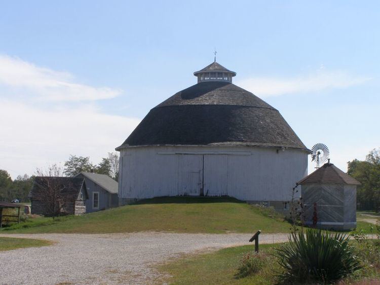
The Bert Leedy Round Barn was listed on the National Register of Historic Places in 1993.
Geography
According to the 2010 census, the township has a total area of 37.6 square miles (97 km2), of which 37.48 square miles (97.1 km2) (or 99.68%) is land and 0.12 square miles (0.31 km2) (or 0.32%) is water.
Unincorporated towns
Adjacent townships
Major highways
Cemeteries
The township contains one cemetery, Sand Hill.
References
Richland Township, Fulton County, Indiana Wikipedia(Text) CC BY-SA