
Opening date 1985 Catchment area 7,485 km² | Construction cost $626 million USD Opened 1985 Surface area 107.8 km² Construction began 1974 | |
 | ||
Operator United States Army Corps of Engineers Similar Savannah River, J Strom Thurmond Dam, Hartwell Dam, New Savannah Bluff Lock, Carters Dam | ||
Richard B. Russell Dam is a concrete-gravity and embankment dam located on the Savannah River at the border of South Carolina and Georgia, creating Richard B. Russell Lake. The dam was built by the U.S. Army Corps of Engineers between 1974 and 1985 for the purposes of flood control, hydroelectricity, recreation, additional stream flow regulation, water supply, and fish and wildlife management. The concrete structure of the dam spans 1,904 feet (580 m) and rises 210 feet (64 m) above the riverbed, housing a hydro-power plant with an installed 600 megawatts (800,000 hp) capacity. The Richard B. Russell Dam is the final large dam completed by the U.S. Army Corps in the Savannah River Basin and lies 30 miles downstream from the Hartwell Dam (1962) and 37 miles (60 km) upstream from the J. Strom Thurmond Dam (1954).
Contents
- Map of Richard B Russell Dam Georgia 30635 USA
- History and constructionEdit
- Dam characteristicsEdit
- Power plantEdit
- References
Map of Richard B. Russell Dam, Georgia 30635, USA
History and constructionEdit
The Flood Control Act of 1966 authorized construction of a new reservoir on the Savannah River to be named Trotters Shoals Lake and Dam. The lake and dam were renamed in 1987 after Georgia senator Richard Brevard Russell, Jr. in the same bill that also renamed Clarks Hill Lake to Lake Strom Thurmond. Construction on the new dam began in 1974 and filling of the lake began in October 1983. The lake reached full pool in December 1984 and the original power plant of four 75 megawatts (101,000 hp) conventional turbine-generators went online in January 1985. In 1992, the addition of four 75 MW reversible pump-turbine units was completed, giving the dam a pumped-storage hydroelectricity capability.
Dam characteristicsEdit
The dam has a total length of 5,224 feet (1,592 m) with its concrete section making up 1,904 feet of that length. The concrete section is flanked on both sides by earthen-embankment dams that total 3,320 feet (1,010 m) long. The concrete section houses the power plant and spillway of the dam. The spillway contains ten-50 by 45 feet (15 m × 14 m) tainter gates that help regulate the reservoir level along with controlling flooding.
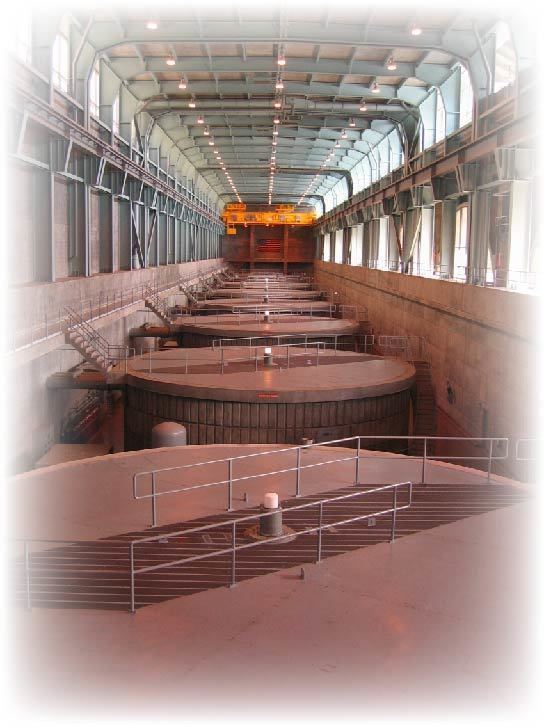
Power plantEdit
The powerhouse is 690 feet (210 m) long and contains eight 75 MW generators. Four generators are conventional turbines and another four are reversible turbines. With the four-reversible turbines, the dam can utilize pumped-storage hydroelectricity by pumping water that is discharged downstream back into the reservoir; essentially "reusing" water.
Since the Russell Dam is primarily a peaking facility, the reversible pump-turbines pump water from the backwaters of Lake Thurmond into Lake Russell during off-peak hours when electricity is cheap and demand is low. During periods of high power demand, the water is released to generate electricity. Power produced by the dam is managed by the Southeastern Power Administration.