
- elevation 924 m (3,031 ft) - elevation 0 m (0 ft) Area 18.48 km² | - elevation 1,239 m (4,065 ft) | |
 | ||
- location Sítio dos Casais da Igreja | ||
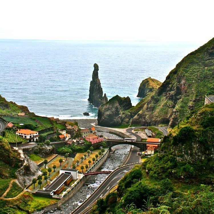
Ilha da madeira ribeira da janela
Ribeira da Janela is a civil parish (Portuguese: freguesia) in the municipality of Porto Moniz in the Portuguese islands of Madeira. The population in 2011 was 228, in an area of 18.48 km².
Contents
- Ilha da madeira ribeira da janela
- Map of Ribeira Da Janela Portugal
- Madeira island stones in ribeira da janela
- History
- Geography
- References
Map of Ribeira Da Janela, Portugal
Madeira island stones in ribeira da janela
History
The parish was marked by a massive exodus during in the 1960s, from which it has yet not recovered.
Geography
It is located northeast coast of the municipality of Porto Moniz, connected by the main roadway that circles the island to the principal communities in Funchal and Calheta. Mountainous, the parish is cut by several river valleys extending into the Atlantic Ocean from the interior plateau of Paul da Serra, where it borders the municipalities of Ponta do Sol and Calheta. The ravine, Ribeira da Janela, meanders through the parish from Paul da Serra (springing from the plateau at around 1,420 metres altitude) and flows at various intervals along the water course. The valley cut by this ravine is one of the longest in Madeira. Forests dominate the northern and the western parts of the valley and while brush permeates in the remaining areas.