
- elevation 1,107 m (3,632 ft) - location Praça do Lyra Area 82.93 km² | - elevation 0 m (0 ft) Local time Friday 5:19 PM | |
 | ||
Weather 8°C, Wind N at 14 km/h, 61% Humidity | ||
Best of madeira island funchal camara de lobos porto moniz hd
Porto Moniz ([ˈpoɾtu muˈniʃ]) is a municipality in the northwest corner of the island of Madeira. It is located west of Santana and Machico, and northwest of Funchal. The population in 2011 was 2,711, in an area of 82.93 km².
Contents
- Best of madeira island funchal camara de lobos porto moniz hd
- Map of Porto Moniz Portugal
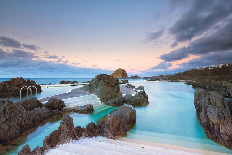
- Porto moniz natural pools madeira island portugal
- History
- Geography
- References
Map of Porto Moniz, Portugal
The municipality features a natural complex of lava pools that are popular with locals and tourists.
Porto moniz natural pools madeira island portugal
History
It is unclear when the area of Porto Moniz was first colonized, although it is likely that it occurred at the beginning of the last quarter of the 15th century. Francisco Moniz O Velho, is referred to as one of these first settlers, who had uncultivated lands in this area and was responsible for establishing a farm and chapel. Francisco Moniz was a nobleman from the Algarve, who married Filipa da Câmara (daughter of Garcia Rodrigues da Câmara). He was one of the sons of João Gonçalves Zarco, the discoverer of Porto Santo (1418) with Tristão Vaz Teixeira and later the island of Madeira with Bartolomeu Perestrelo (1419).
The municipality was created on 31 October 1835, but was quickly abolished and reestablished successively in 1849-1855, 1867-1871 and again in 1895-1898.
Geography
Administratively, the four parishes of Porto Moniz include: