
Existed: by 1934 – present Length 41.4 km | ||
 | ||
North end: Central Street in Millville, MA Counties | ||
Route 5 is a state highway in the U.S. state of Rhode Island. It runs approximately 26 miles (42 km) from US 1 in Warwick to the Massachusetts state line in North Smithfield.
Contents
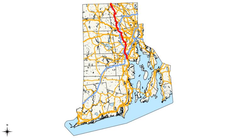
Map of RI-5, Rhode Island, USA
Route description
Route 5 starts at US 1 in Warwick near Gorton Pond. It runs north over I-95 without an interchange before intersecting Route 2 in Cranston. It continues north, generally paralleling I-295. After passing US 44 near Greenville, Route 5 crosses the Stillwater Reservoir on a short causeway. Continuing north, Route 5 has a short concurrency with Route 7, and it continues to North Smithfield. Route 5 crosses the Route 146 expressway without an interchange and terminates at the Massachusetts state line, though the northernmost Route 5 shields are around Route 102 at the south end of the Route 146A concurrency.
History
Route 5 was once numbered Route 1C along the 3.0 miles (4.8 km) between its south end at U.S. Route 1 (New England Interstate Route 1 before 1926) and Route 2 (originally Route 1A). It was renumbered Route 5 and extended north by 1934.