Time zone CET (UTC+1) Website www.kreis-sim.de Capital Simmern | Vehicle registration SIM, GOA Population 101,854 (2013) | |
 | ||
Points of interest Rhine Gorge, Rheinfels Castle, Kastellaun Castle, Hochwildschutzpark Hunsrück, Mittelrhein‑Klettersteig Boppard Destinations | ||
Rhein-Hunsrück-Kreis is a district (Kreis) in the middle of Rhineland-Palatinate, Germany. The neighbouring districts are (from north clockwise) Mayen-Koblenz, Rhein-Lahn, Mainz-Bingen, Bad Kreuznach, Birkenfeld, Bernkastel-Wittlich, Cochem-Zell.
Contents
- Map of Rhein HunsrC3BCck Kreis Germany
- History
- Geography
- Partnerships
- Towns and municipalities
- References
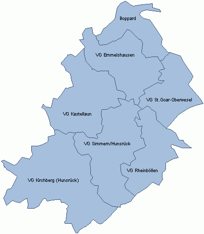
Map of Rhein-Hunsr%C3%BCck-Kreis, Germany
History
The district was created in 1969, when the districts of St. Goar and Simmern were merged. In 2014 it was expanded with the municipalities Lahr, Mörsdorf and Zilshausen, previously part of Cochem-Zell.
Geography
The name of the district already mentions the two main geographic features of the district - the river Rhine which forms the boundary to the north-east and the hills of the Hunsrück cover most of the area of the district.
The Frankfurt-Hahn Airport is located in the district.
Partnerships
In 1962, Simmern began a friendship pact with the French region Bourgogne, which was continued after the merging with the St. Goar. In 1985 a partnership was started with the district Nyaruguru (at that time called the municipality Rwamiko) in Rwanda, as part of the partnership of the Rhineland-Palatinate region with Rwanda. In 1999, a partnership with the Hungarian Zala County began.
Towns and municipalities
Verband-free town: Boppard
