
Time zone CET (UTC+1) Website kreis-badkreuznach.de | Vehicle registration KH Population 155,297 (2013) | |
 | ||
Points of interest Schmidtburg, Disibodenberg, Kornmarkt, Rheinland‑Pfälzisches Freilichtmuseum Bad Sobe, Rittergut Bangert Destinations | ||
Bad Kreuznach is a district in Rhineland-Palatinate, Germany. It is bounded by (from the north and clockwise) the districts of Rhein-Hunsrück, Mainz-Bingen, Alzey-Worms, Donnersbergkreis, Kusel and Birkenfeld.
Contents
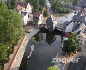
Map of Bad Kreuznach, Germany
History
The region is full of medieval castles, especially along the Nahe River. Best known is the Kyrburg of Kirn, built in the 12th century and sitting in state above the river.
In 1815 the district of Kreuznach was established by the Prussian government. In 1932 it was merged with the district of Meisenheim. The name of the district officially changed from Kreuznach to Bad Kreuznach in 1969.
Geography
The district is located in the hilly country between the mountain chains of the Hunsrück in the north and the North Palatine Uplands in the south. The main axis of the district is the Nahe River, which enters the territory in the west, runs through Kirn, Bad Sobernheim and Bad Kreuznach, and leaves to the northeast.
The region formed by this district and the adjoining Birkenfeld district is known as the Naheland. The banks of the lower Nahe are used for vineyards. Away from the stream there are sparsely populated forests crisscrossed by the narrow affluents of the Nahe River.