
Elevation 145 m (476 ft) Local time Saturday 2:30 PM ISO 3166 code ISO 3166-2:IN | Sub-Tehsil Rawla mandi Population 12,947 (2011) Area code 01506 | |
 | ||
District Shri Ganganagar district Weather 36°C, Wind NW at 8 km/h, 17% Humidity Neighborhoods Master Colony, Ward No. 12, Ward No. 8, Suraj Colony, Keshav Colony, Ramdev colony, Basant Colony | ||
Rawla Mandi (in Hindi and Rajasthani:- रावला मंडी, in Punjabi:- ਰਾਵਲਾ ਮਂਡੀ, in Sindhi:- راولا منڊي) is a small town in Sri Ganganagar district of Rajasthan, India. It is located on Gharsana-Khajuwala road, 24 km away from Gharsana and 180 km from the district headquarters Sri Ganganagar. The state capital Jaipur is 480 km away, and national capital New Delhi is 600 km away. It is 55 km from Anupgarh, 33 km from Khajuwala and 122 km from Bikaner.Rawla mandi known as 8PSD (B) gram panchayt.
Contents
- Map of Rawla Mandi Rajasthan 335707
- Extent geography and climate
- Minerals
- Governance
- Chaks of Rawla mandi
- Timeline
- The question of wards of 10 and 11
- Economy
- Industries
- Demographics
- According to census 2001
- Culture
- Transport to other cities and villages
- Sports
- Government buildings and facilities
- Anupgarh branch of Ignp canal
- Social organisations
- Fauna animals
- Colleges
- Schools
- Educational institutes
- Ambedker reading room and library
- Miscellaneous
- References
Map of Rawla Mandi, Rajasthan 335707
Extent, geography and climate
Rawla Mandi is in the Thar Desert. Thorny shrubs and sandy dunes are the basic characteristics of this region. Kikar(Acacia), Aak (Calotropis procera), Khejari (Prosopis cineraria), Khimp (Leptadenia pyrotechnica), Lathiya, Laana and Booiin (Aerva tomentosa) make natural vegetation of this area. According to experts Rawla area is enriched with fertile soil for crops. Gypsum rocks are assets of this region. The waters of Ignp canal has brought changes to flora and fauna and agriculture of wheat, mustard, cotton, Guar, pulses and Jawar has given a composite form of sandy dunes and green fields. It should be noted that this region with Gharsana is called cotton-belt but now things are changing. Average annual rainfall has fallen dramatically in the last few years. Since key source of irrigation is canal-water, water supply is inadequate for agriculture. Now many farmers are moving to a new trend of irrigation by tubewells.
Rawla Mandi lies roughly between 72.87'72"E to 72.90'E longitudes and 28.83'25"N to 28.85N' latitudes. Details as follows:
Minerals
Gypsum is most common mineral found in the rocks of this area.The gypsum deposits occur in rocks of tertiary period(roughly from 6.6 crore to 25.8 lakhs years old period), and are considered to have by evaporation process.
Governance
Rawla Mandi is currently a gram panchayat local government. Rawla mandi is divided into 17 wards.
The current sarpanch is Sunita Devi, who was elected on 18 January 2015. Manju Devi is serving as vice-sarpanch who is also ward panch from ward no.15. Total ward members are listed below:
Chaks of Rawla mandi
Rawla Mandi grampanchayat is divided into 5 chaks. These are 8 PSD B, 8 PSD A, 2 DOL, 1KPD A and 1 KDP B.Main town of Rawla Mandi is associated with 8 PSD B. Rawla Mandi grampanchayat is known as 8 PSD B. 10 KD,9 PSD (A), 10 KPD and 4KPD are neighbouring grampanchayats of Rawla Mandi grampanchayat.
Timeline
Rawla is not an old village. The Anoopgarh branch of the IGNP canal brought the waters of the Satluj and Beas rivers in 1967 and at that time some people opened their shops near the bridge built on the canal for labourers and farmers working on the canal site.
In 1982 a new grain market was established. Rawla began to expand and the golden period of Rawla began. On 19 August 1987 a number of illegal shops were demolished by the administration and people showed strong resistance. Earlier Rawla Mandi was a part of Rojari gram panchayat and in 1988 it was given grampanchayat status. Gangabishan Poonia was elected as first Sarpanch on 1 June 1988. Hardworking and dedication changed the life of the people of Rawla. By 2000 Rawla began to decline due to droughts and lack of water in the canal. Many residents left the town and the people became hopeless and sad. The people of Anoopgarh, Gharsana, Khajuwala and Rawla Mandi started a movement against state government. The people of Rawla were demanding sufficient water for agriculture. According to them government had discriminatory attitude between people of first phase and second phase of Ignp irrigation system but government was claiming due to bad rain conditions water supply in Ignp canal had decreased and water was being given as per proportion of both phases. Rawla came into the news when this peasant movement became violent when a gathering of farmers entered a police station and set it afire on 27 October 2004. Three persons Kaluram, Mangilal, and Rajkumar died in police firing. A curfew was imposed on the area.
At present the shortage of water for agriculture is the most serious challenge for the people of Rawla Mandi. Now again due to positive rain conditions and water supply in the canal again this area is moving on the path of progress.
Road divider and road lights were introduced in 2011. 2012:- Rawla Mandi Sub-Tehsil is set up and Rawla mandi will be the headquarters of this sub-tehsil. In 2013 area east to Rojari road (for example ward no. 11 etc.) given back to 9 psd a grampanchayat. Many years ago it was added to 8 psd b grampanchayat. 2016:- Action against encroachment in land along canal began by government administration on 25 January in its first phase from bridge on Khanuwali road,but it razed 2or 3 small buildings built within 25 feet of canal boundary. April:-The cctv cameras mounted on road light poles at Rojari chowk and Shiv chowk.The cameras has been fixed first in Rawla Mandi at public places.
The question of wards of 10 and 11
According to map Rawla mandi or grampanchayat 8 PSD-B consists 5 Chaks or land pieces.ward no 11 and 10 are not parts of these chaks. These wards are on chak 6 PSD C,which is a part of grampanchayat 9 PSD A.It consists 56 Bighas land. In 1996 deliberately or by mistake this 56 bighas land as ward no.10 and 11 were incorporated into Rawla Mandi. Almost after 10 years Gram panchayat 9 PSD-A demanded back these areas on the basis of fact that these were originally inhabited on the land of grampanchayat 9 PSA-A. However this matter in now in court. On Aug-Sept 2013 both sarpanches of Rawla mandi and 9 PSD-A with their supporters kept dharna before police station with different hues of problem of these wards.Rawla mandi sarpanch was demanding not to commence any action in these wards,where as sarpanch of 9 PSD-A stated that he has full right to start action against encroachment and issues pattas in these parts. After written assurance of BDO to demands of Rawla sarpanch dharna was put to end by Rawla mandi sarpanch. On 12 sep 2013 by a letter by Panchayat Raj department of Rajasthan government it was made clear that land concerning wards 10 and 11 was under administration of gram panchayat 9 PSD-A and 9 PSD A grampanchayat was free to initiate any action against encroachment and issue pattas in these wards.
Economy
People are mainly dependent on agriculture-based trades.
Industries
As far as industries is concerned gypsum grinding factories occupy the most important place. Raw gypsum material is supplied from villages. The government central processing unit is the perhaps largest unit in the Asian continent. After grinding, gypsum is transported to other northern Indian cities where gypsum based large scale industries use it as raw material. There was a time when Rawla area was known for its high yield of cotton. A number of factories for processing cotton were shut down in recent decade. The industrial area or Riico is located in easternmost part of Rawla Mandi. Various markets work to fulfill needs of people of town and surrounding villages.
Demographics
Population as per 2011 census is as below.
According to census 2001
Total population was 13712 according to census of 2001. Among these 7315 are males and 6397 was female population, and mean sex ratio was 874.
Culture
Bagri, Punjabi, Hindi, Sindhi and Marwari languages are spoken here. People practice Hindu and Sikh religions. Some people have faith in Islam also. Dera-culture is also here. Many people follow Radha swami, Sacha sauda and Nirankari Mission Deras.
Transport to other cities and villages
Rajasthan roadway Buses are only public means of transport in Rawla Mandi. Private bus services are other option of transport to other cities and villages. Private taxis are also available to move to nearby villages.
Main roads from Rawla Mandi to other cities and villages * 1 MDR 103 (Gharsana-Khajuwala road) :-This road connectes to 281 Head, 12 Mld, Gharsana on the north and Shekhra, Khajuwala on the south-west. * 2 365 head or KND road :- This emerges in west side of Rawla and helps to reach 7 KND, Khanuwali and then 365 head. * 3 Sakhi road :- This road emerges from above mentioned KND road and connects with Rawla village, Sakhi and then Gharsana. * 4 Dandi road :- This road begins from Keshav colony and connects with KPD villages, Dandi,Sattasar and then Bikaner. * 5 Rojri road :- This road emerges on the east part of Rawla Mandi and used to transport to Bikaner. It connects to Rojri where it gets merged with Gharsana-Bikaner road. * Dol road :- On the western end of Rawla this road helps to reach 7 DOL.
Sports
*1 Cricket is popular among youth. Devabai smriti cup cricket tournament was first tournament in Rawla Mandi held in 1992. Final was played between Bikaner team and Deengarh team and Bikaner won. In first tournament of Rawla Mandi, Mr. Chandu declared 2rs. for each four.
It was held in Gharsana and Rawla Mandi in Dec. 2012.
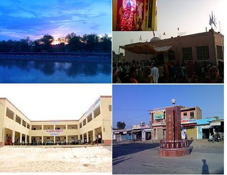
Government buildings and facilities
The government runs the local schools, a primary health care centre, veterinary hospital, and the Office of Forest Department. The police station services the southern half region of Gharsana tehsil in addition to the town. The State Bank of India (SBI), Oriental Bank of Commerce (OBC) and the Ganganagar Cooperative Bank also operate here. ATM facilities are available at the SBI and OBC banks. Rawla mandi has a branch level post office under Gharsana Post Sub-offic.
Anupgarh branch of Ignp canal
Anupgarh canal is the region's main water source. This forms the northwestern border of the town and at R.D.321 a bridge cum head is built,where KND and KPD two distributories gets water from canal. This canal is lined by bricks. Few years ago a Khadwanja (a brick road) is made on the both either banks of canal. In the town side valuable land along the canal has been occupied by various people and they have built pacca houses. People also using banks to dump garbage and litter. For many people banks are used for morning walk and jogging.
Social organisations
Many social organisations are active contributing in social life of town.
Fauna (animals)
The waters of canals has changed both flora and fauna of this area. Apart from domestic and common animals Rawla area has also some wild animals. Rojh or Neelgai (Boselaphus tragocamelus) are common mammals found in farms and sandy dunes. Farmers have to care about their crops from these animals. Sometimes Neelgai comes on roads and becomes reason of accidents. The snakes, Goh, Sanha(Sanda), wild rats etc. are other wild animals of this area.
Colleges
Schools
(A) Senior Secondary schools:-
(B) Secondary schools:-
(C) Middle and Primary schools:-
(D) English medium schools:-
Educational institutes
Ambedker reading room and library
The Ambedker reading room and library was established on 26th February 2017.
Miscellaneous
Rawla Mandi has various political and governance issues. People have to travel about 180 km for their works at district level. The demand for Sub-tehsil at Rawla Mandi has been raised many times because tehsil headquarters Gharsana is 30 km from Rawla Mandi. Rawla Mandi govt. Sen sec school is facing problem of lacking of staff and student after tenth have to opt only arts subjects.