
Country India District Anupgarh PIN 335701 Elevation 155 m Population 30,877 (2011) | State Rajasthan Time zone IST (UTC+5:30) Telephone code 01498 Area 4.68 km² Area code 01498 | |
 | ||
Weather 26°C, Wind SE at 13 km/h, 19% Humidity | ||
Anupgarh market
Anoopgarh is a District in the state of Rajasthan, India. It is the headquarters town for Anoopgarh.
Contents
Map of Anupgarh, Rajasthan 335701
Geography
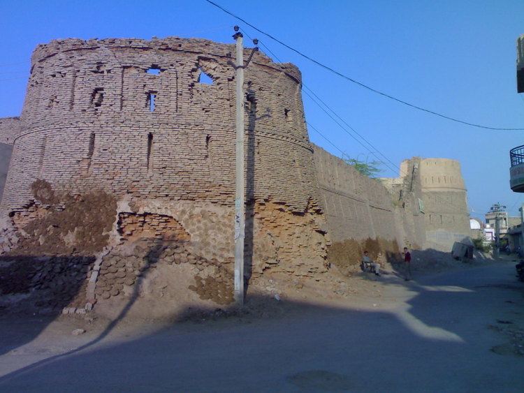
Anoopgarh has an average elevation of 155 metres (508 feet), and is very close to the border with Pakistan. The fort at Anoopgarh was built about 1689 by the Mughal governor to help suppress the local Bhati Rajputs who were rebelling.
Demographics
In the 2001 India census, the town of Anoopgarh had a population of 29,548. Males constituted 54% of the population and females 46%. Anoopgarh had an average literacy rate of 61.2%, higher than the national average of 59.5%; with 67.3% of the males and 54.0% of females literate. In 2001 in Anoopgarh, 15.6% of the population was under six years of age. The majority of the population in Anoopgarh speaks the Punjabi, Hindi and Rajasthani language.