
Surface area 6,302 acres (2,550 ha) Max depth 45 m Mean depth 18 m | Type mesotrophic Area 25.5 km² Surface elevation 463 m | |
 | ||
Catchment area 100 square miles (260 km) Islands Maneskootuk Island, South Bog Islands Similar Saddleback Maine, Saddleback Mountain, Rangeley Lake State Park, Smalls Falls, Wilhelm Reich Museum | ||
Rangeley lake resort in maine
Rangeley Lake is located in Franklin County, Maine in the United States. It is fed by several streams. Its waters flow out from the lake's northwestern end into the short Rangeley River, then into Mooselookmeguntic Lake, and ultimately into the Androscoggin River, Merrymeeting Bay, the lower Kennebec River, the Gulf of Maine and the Atlantic Ocean.
Contents
- Rangeley lake resort in maine
- Map of Rangeley Lake Maine 04970 USA
- Rangeley lake state park maine
- Rangeley Lake Seaplane BaseEdit
- References
Map of Rangeley Lake, Maine 04970, USA
The lake is one of the major headwater lakes of the Androscoggin watershed. Its elevation is 1,518 feet (463 m) above sea level and its area is about 10 square miles (26 square km). The lake's depth is shallow near the shore with a central basin averaging about 95 feet (29 m) deep (29 m). The maximum depth is 149 feet (45 m).
It occupies parts of the Franklin County's Minor Civil Divisions of Rangeley and Rangeley Plantation. The town of Rangeley is located on the northeastern shore of Rangeley Lake.
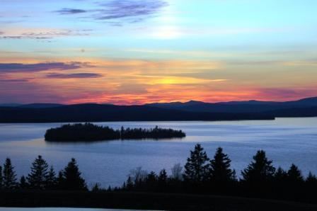
Maneskootuk Island (also called Doctors Island) is in the eastern part of Rangeley Lake. In the western part there is a small group of islands collectively called South Bog Islands.
Rangeley lake state park maine
Rangeley Lake Seaplane BaseEdit
Rangeley Lake has a designated water landing zone for seaplanes (United States Aerodrome M57 – Rangeley Lake Seaplane Base). This aerodrome is one of only a very few aerodromes in the world to be serviced by a GPS instrument approach aligned to a water aerodrome, as well as an NDB approach; almost all other instrument approaches are aligned to runways on land surfaces such as pavement, asphalt, gravel, or turf.