
Incorporated 1994 Website www.ramara.ca Local time Thursday 11:28 PM | County Simcoe Time zone Eastern (EST) (UTC-5) Population 9,488 (2016) Area code Area codes 705 and 249 | |
 | ||
Weather -1°C, Wind SE at 16 km/h, 49% Humidity | ||
Ramara is a lower-tier township municipality in Simcoe County, Ontario, Canada.
Contents
Map of Ramara, ON, Canada
Ramara was formed in 1994 through the amalgamation of the townships of Rama and Mara. The municipality stretches along the northeastern shore of Lake Simcoe from Gamebridge to Orillia, and along the entire eastern shore of Lake Couchiching from Orillia to Washago. Farming, tourism and aggregate are the primary industries, and are supported by a wide variety of local enterprises. The area is perhaps best known as the home of Casino Rama, which is actually located on the neighbouring First Nations reserve of Chippewas of Mnjikaning First Nation in Rama.
Communities
The township comprises the communities of Atherley, Bayshore Village, Bayview Beach, Bonnie Beach, Brechin, Brechin Beach, Brechin Point, Concord Point, Cooper's Falls, Fawkham, Floral Park, Fountain Beach, Gamebridge, Gamebridge Beach, Geneva Park, Glenrest Beach, Grays Bay, Floral Park, Hopkins Bay, Joyland Beach, Lagoon City, Lakeview Beach, Little Falls, Longford Mills, Mara Beach, Mariposa Beach, McDonald Beach, Millington (ghost town), Murphy Beach, New Gamebridge Beach, Oaklawn Beach, O'Connell, Orkney Point, Orkney Beach, Paradise Point, Point of Mara Beach, Prophet Beach, Rathburn, Riverside Beach, Sandy Beach, Sandy Pine Beach, Southview Cove, Talbot, Tanglewood Beach, Udney, Uptergrove, Val Harbour and Washago.
Brechin is one of the townships largest communities. It is known for its several local businesses such as a Coffee Time and a Statue Store. The town has all the necessities of a small town, such as a Foodland, LCBO, Legion, Ultramar, schools and churches. The town is also a central meeting location for the area's youth where they partake in numerous recreational activity involving the town's proximity to the lake.
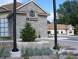
The Township of Ramara owns and operates the Ramara Centre, located at 5482 Highway 12, between Atherley and Uptergrove. The Township of Ramara also owns community centres in Longford, Udney and Brechin that are operated by Community Centre Boards of Management which are composed of volunteers.
There are three fire halls in the Township. Fire Hall #1 is located at 3290 County Road 47, Brechin at the corner of County Rd. 47 & Hwy. 12. Fire Hall #2 is located at 85 Patricia Drive, Atherley at the corner of Patricia Drive & Balsam Rd. Fire Hall #3 is located at 7305 Simcoe County Rd. 169, Washago at County Rd #169 & Switch Road.
The Ontario Lumberjack Championships were held at the Brechin Ball Park on the second Saturday in June in 2012, 2013 and 2014.
History
The former townships of Rama and Mara were first named in 1820. The origins of the names are unclear, as both may be either Spanish words (rama for "branch" and mara for "sea") or Biblical references (rama for Ramah, the biblical town of Benjamin in ancient Israel, and mara for Marah, named in the biblical Book of Exodus as the place where Moses sweetened the bitter waters for the Israelites.) As both styles of place naming were popular in Ontario at the time, it is not clear which one Lieutenant-Governor Sir Peregrine Maitland had in mind.
The townships were originally part of York County, but were transferred to Ontario County when they were first incorporated as an amalgamated municipality in 1852. They were later reincorporated as separate municipalities in 1869.
A portion of Rama Township was allocated to form what became the Mnjikaning First Nation 32 Indian reserve of the Chippewas of Mnjikaning First Nation. Many natives were living on the narrow strip of land that separates lakes Simcoe and Couchiching between Atherley and Orillia. These lands were surrendered by treaty in 1836. After that time, the local Indian Agent began purchasing lands in Rama Township and the natives were relocated there. The main settlement on the reserve is also known as Rama and is the site of Casino Rama.
North of Rama, the community of Longford Mills was established in 1868. In 1867 American lumberman Henry W. Sage had purchased blocks of land in Rama Township after buying timber berths in Oakley Township in Muskoka District. Sage had considered relocating his mill from Bell Ewart to a point between the Black River and Lake Couchiching, or possibly at Wasdell Falls. This area lacked rail transport, so the sawn lumber would have to be barged to the Northern Railway at Bell Ewart. Instead, Sage came up with the idea of a canal to float logs from the Black River to supply the mills of Lake Simcoe. The Rama Timber Transport Company was formed in 1868. Not only did it allow the logs of Muskoka and Victoria reach the mills of Lake Simcoe, but helped establish the community of Longford Mills.
Ontario County was dissolved upon the formation of the Regional Municipality of Durham in 1974, and both townships were transferred to Simcoe County. As part of the municipal restructuring of Simcoe County, Mara and Rama Townships were reamalgamated to form Ramara in 1994.
Rail
Washago railway station is located within the township served by VIA Rail's Canadian service from Toronto and formerly with Ontario Northland Railway's Northlander service.
The gingerbread style Atherley Junction Railway Station was built by the Grand Trunk Railway and now the structure is now located at Couchiching Beach Park in Orillia, Ontario.
Bus
There is bus service from Toronto to Washago (Bus Station) operated by Ontario Northland. As well, there is extensive charter bus service to Casino Rama.
Car
Ontario Highway 12 (Trans Canada Highway) is a main connecting road between Ontario Highway 169 and Rama Road (Simcoe County Road 44).
Air
Closest airport is Lake Simcoe Regional Airport located between Barrie, Ontario and Orillia, else Toronto Pearson Airport in Toronto via Highway 12 and Highway 400.
Demographics
According to the 2011 Statistics Canada Census: