
Named for Daniel Ralls Website www.rallscounty.com Founded 1820 | Area 1,254 km² Population 10,192 (2013) Unemployment rate 4.6% (Apr 2015) | |
 | ||
Rivers Salt River, Purdey Creek, East Lick Creek, Spencer Creek | ||
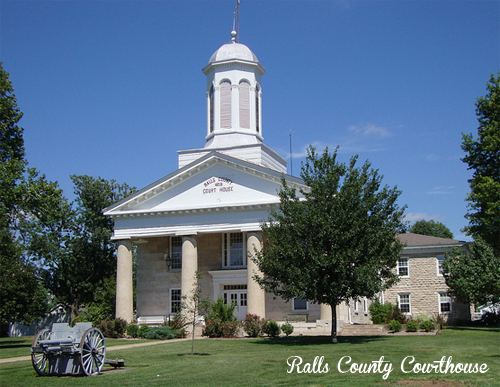
33 acres ralls county missouri
Ralls County is a county located in the northeastern portion of the U.S. state of Missouri. As of the 2010 census, the population was 10,167. Its county seat is New London. The county was organized November 16, 1820 and named for Daniel Ralls, Missouri state legislator.
Contents
- 33 acres ralls county missouri
- Map of Ralls County MO USA
- History
- Geography
- Adjacent counties
- Major highways
- Demographics
- Public schools
- Local
- State
- Federal
- Missouri Presidential Preference Primary 2008
- References
Map of Ralls County, MO, USA
Ralls County is part of the Hannibal, MO Micropolitan Statistical Area, which is also included in the Quincy-Hannibal, IL-MO Combined Statistical Area.
History
Ralls County was one of several along the Mississippi River settled in the early years primarily by European-American migrants from the Upper South, especially Kentucky and Tennessee. They brought slaves and slaveholding traditions with them, and quickly started cultivating crops similar to those in Middle Tennessee and Kentucky: hemp and tobacco. They also brought characteristic antebellum architecture and culture. Ralls is considered one of the counties in the outer ring of what is called the Little Dixie region. Most of the Little Dixie counties are located further west along the Missouri River, from Callaway County west.
Geography
According to the U.S. Census Bureau, the county has a total area of 484 square miles (1,250 km2), of which 470 square miles (1,200 km2) is land and 14 square miles (36 km2) (2.9%) is water.
Adjacent counties
Major highways
Demographics
As of the census of 2010, there were 10,167 people, 3,736 households, and 2,783 families residing in the county. The population density was 20 people per square mile (8/km²). There were 4,564 housing units at an average density of 10 per square mile (4/km²). The racial makeup of the county was 97.93% White, 1.11% Black or African American, 0.20% Native American, 0.08% Asian, 0.01% Pacific Islander, 0.04% from other races, and 0.62% from two or more races. Approximately 0.44% of the population were Hispanic or Latino of any race. 30.1% were of American, 27.3% German, 10.5% English and 10.4% Irish ancestry.
There were 3,736 households out of which 34.00% had children under the age of 18 living with them, 64.20% were married couples living together, 6.50% had a female householder with no husband present, and 25.50% were non-families. 21.20% of all households were made up of individuals and 10.00% had someone living alone who was 65 years of age or older. The average household size was 2.55 and the average family size was 2.95.
In the county, the population was spread out with 25.20% under the age of 18, 7.10% from 18 to 24, 26.90% from 25 to 44, 26.50% from 45 to 64, and 14.20% who were 65 years of age or older. The median age was 39 years. For every 100 females there were 100.90 males. For every 100 females age 18 and over, there were 98.90 males.
The median income for a household in the county was $37,094, and the median income for a family was $41,955. Males had a median income of $28,139 versus $20,238 for females. The per capita income for the county was $16,456. About 6.60% of families and 8.70% of the population were below the poverty line, including 9.70% of those under age 18 and 10.70% of those age 65 or over.
Public schools
Local
Historically, the Democratic Party predominantly controlled politics at the local level in Ralls County. However, all local seats up for election with a republican candidate during the November 2016 election cycle were won by Republicans. Republicans now hold the office of Sheriff, Coroner, and Western District Commissioner.
State
Ralls County is a part of Missouri’s 40h District in the Missouri House of Representatives and is represented by Jim Hansen (R-Frankford).
Ralls County is a part of Missouri’s 18th District in the Missouri Senate and is currently represented by Brian Munzlinger (R-Williamstown).
Federal
Ralls County is included in Missouri’s 6th Congressional District and is currently represented by Sam Graves (R-Tarkio) in the U.S. House of Representatives.