
Founded December 23, 1826 Population 28,904 (2013) Unemployment rate 4.8% (Apr 2015) | Area 1,150 km² | |
 | ||
Rivers Fabius River, Fall Creek, Pee Dee Creek, Mills Creek Colleges and Universities Hannibal–LaGrange University, Marion College, Philadelphia | ||
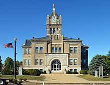
810 acres in marion county missouri
Marion County is a county located in the northeastern portion of the U.S. state of Missouri. As of the 2010 census, the population was 28,781. Its county seat is Palmyra. Unique from most third-class counties in the state, Marion has two county courthouses, the second located in Hannibal. The county was organized December 23, 1826 and named for General Francis Marion, the "Swamp Fox," who was from South Carolina and served in the American Revolutionary War. The area was known as the "Two Rivers Country" before organization.
Contents
- 810 acres in marion county missouri
- Map of Marion County MO USA
- Geography
- Adjacent counties
- Major Roadways
- Demographics
- Public schools
- Private schools
- Post secondary
- Local
- State
- Federal
- Missouri Presidential Preference Primary 2008
- Communities
- References
Map of Marion County, MO, USA
Marion County is part of the Hannibal, Missouri Micropolitan Statistical Area, which is included in the Quincy-Hannibal, IL-MO Combined Statistical Area.
Geography
According to the U.S. Census Bureau, the county has a total area of 444 square miles (1,150 km2), of which 437 square miles (1,130 km2) is land and 7.4 square miles (19 km2) (1.7%) is water.
Adjacent counties
Major Roadways
Demographics
As of the census of 2010, there were 28,781 people, 11,066 households, and 7,524 families residing in the county. The population density was 65 people per square mile (25/km²). There were 12,443 housing units at an average density of 28 per square mile (11/km²). The racial makeup of the county was 93.26% White, 4.62% Black or African American, 0.27% Native American, 0.28% Asian, 0.08% Pacific Islander, 0.18% from other races, and 1.32% from two or more races. Approximately 0.89% of the population were Hispanic or Latino of any race. 28.5% were of German, 25.6% American, 11.0% Irish and 10.3% English ancestry.
There were 11,066 households out of which 33.30% had children under the age of 18 living with them, 53.50% were married couples living together, 11.40% had a female householder with no husband present, and 32.00% were non-families. 28.10% of all households were made up of individuals and 13.80% had someone living alone who was 65 years of age or older. The average household size was 2.44 and the average family size was 2.98.
In the county, the population was spread out with 25.70% under the age of 18, 9.50% from 18 to 24, 26.40% from 25 to 44, 21.70% from 45 to 64, and 16.60% who were 65 years of age or older. The median age was 37 years. For every 100 females there were 89.40 males. For every 100 females age 18 and over, there were 85.70 males.
The median income for a household in the county was $31,774, and the median income for a family was $41,290. Males had a median income of $30,935 versus $20,591 for females. The per capita income for the county was $16,964. About 9.30% of families and 12.10% of the population were below the poverty line, including 15.30% of those under age 18 and 10.50% of those age 65 or over.
Public schools
Private schools
Post-secondary
Local
The Democratic Party predominantly controls politics at the local level in Marion County. Democrats hold all but two of the elected positions in the county.
State
Marion County is in Missouri's 5th district in the Missouri House of Representatives, with Lindell F. Shumake (R-Hannibal) representing the district.
All of Marion County is a part of Missouri’s 18th District in the Missouri Senate; it is represented by Brian Munzlinger (R-Williamstown).
Federal
Marion County is included in Missouri’s 6th Congressional District and is represented by Sam Graves (R-Tarkio) in the U.S. House of Representatives.