
Number of Tehsils 3 | Area 12,318 km² | |
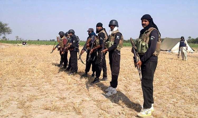 | ||
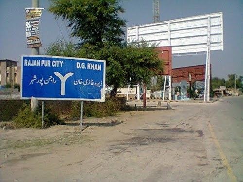
Search operation in rajanpur district
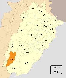
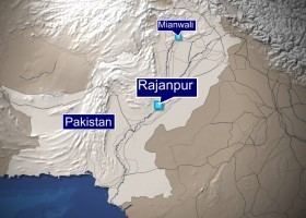
Rajanpur District (Urdu: ضِلع راجن پُور), is a district of Punjab province in Pakistan. According to the 1998 census of Pakistan it had a population of 1,103,618 of which 14.27% were urban. Its administrative centre is Rajanpur.
Contents
- Search operation in rajanpur district
- Mandhi weekly shopping outlet view in rajanpur district punjab
- Administrative divisions
- Etymology and geography
- Demographics
- History
- Education
- Agriculture
- Canal irrigation
- Rod Kohi Hill Torrents
- Floods
- Places
- References
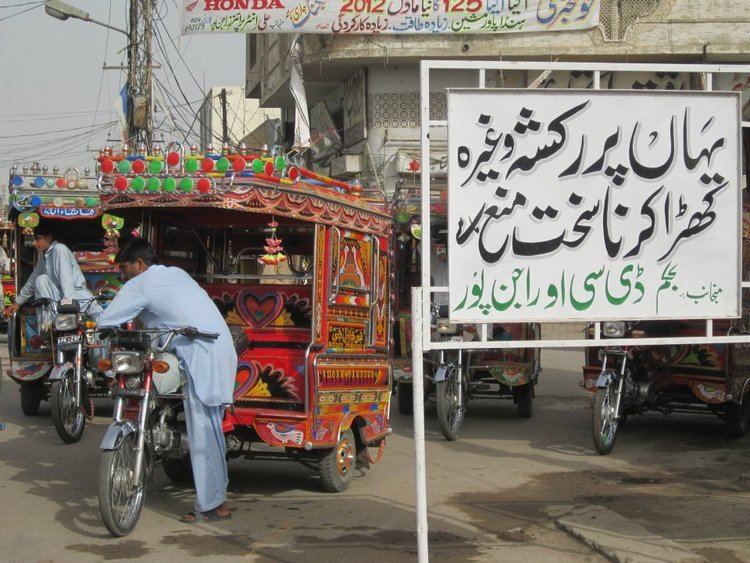
Mandhi weekly shopping outlet view in rajanpur district punjab
Administrative divisions
The district of Rajanpur is divided into three tehsils, which contain a total of 44 Union Councils:
Etymology and geography
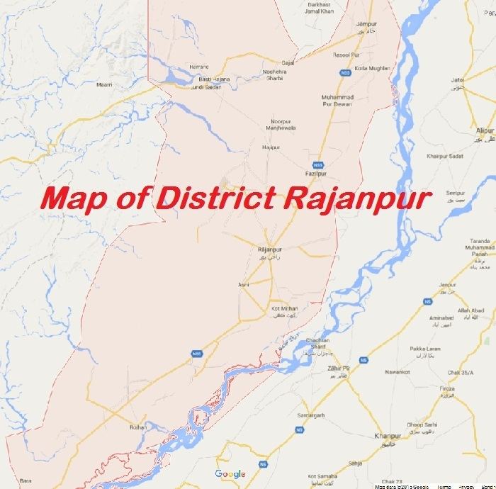
Rajanpur District derives its name from the town of Rajanpur which was founded by Makhdoom Sheikh Rajan Shah about 1770. Rajanpur District was carved out from Dera Ghazi Khan District in 1982. Rajanpur is situated on the right bank (west side) of River Indus. It is bounded on the north by Dera Ghazi Khan District, to the west by Dera Bugti District of Balochistan, to the east by Muzaffargarh and Rahim Yar Khan districts, in the south lies Kashmore District of Sindh Province. The Sulaiman Mountains rise to the west of the district.
Demographics
Rajanpur is the headquarters of Rajanpur District and Tehsil, is located in the extreme southwest part of Punjab, Pakistan (29:06N, 70:19E) with a geographical span of 12,319 km2. It is one of the only two districts of Punjab located west of the Indus River. The land is sandwiched by river Indus on one side, while the Sulaiman mountains range on the other. According to the National Census Report 1998, it had a population of 1,103,618 of which 14.27% were urban. Under the local administrative break up, whole district is divided into three Tehsils and 43 Union Councils (UCs).
The most widely used first language of the district is Saraiki, spoken by 76% of the population. Balochi is spoken by 17%, Punjabi – by 3.3% and Urdu – by 3.2%.
History
The Vedic period is characterized by Indo-Aryan culture that flourished in Punjab region. The Kambojas, Daradas, Kaikayas, Madras, Pauravas, Yaudheyas, Malavas and Kurus invaded, settled and ruled ancient Punjab region. After overrunning the Achaemenid Empire in 331 BCE, Alexander marched into present-day Punjab region with an army of 50,000. The Rajanpur was ruled by Maurya Empire, Indo-Greek kingdom, Kushan Empire, Gupta Empire, White Huns, Kushano-Hephthalites and Shahi kingdoms.
In 997 CE, Sultan Mahmud Ghaznavi, took over the Ghaznavid dynasty empire established by his father, Sultan Sebuktegin, In 1005 he conquered the Shahis in Kabul in 1005, and followed it by the conquests of Punjab region. The Delhi Sultanate and later Mughal Empire ruled the region. The Punjab region became predominantly Muslim due to missionary Sufi saints whose dargahs dot the landscape of Punjab region.
After the decline of the Mughal Empire, the Sikh Empire invaded and occupied Rajanpur District. The Muslims faced restrictions during the Sikh rule. During the period of British rule, Rajanpur district increased in population and importance.
The predominantly Muslim population supported Muslim League and Pakistan Movement. After the independence of Pakistan in 1947, the minority Hindus and Sikhs migrated to India while the Muslim refugees from India settled in the Rajanpur District.
Education
Rajanpur has a total of 1,160 government schools out of which 41 percent (480 schools) are for girl students. The district has an enrolment of 148,746 in public sector schools.
Agriculture
Agriculture in Rajanpur depends solely upon canal irrigation since rainfall is negligible in the region. The five rivers of the Punjab meet at the locality of Wang near Mithankot; hence these rivers provide water for irrigation as well as for domestic usage. Rainfall occurs during the monsoon season (July–September). Occasional heavy rainfall causes flooding in this region, but such floods are rare. In Rajanpur, flood waters come from the Koh Sultan and Shacher torrents (rivulets), as well as the Indus.
Rajanpur district is famous for cotton and sugarcane crop, although they are cultivating wheat and rice as well and tobacco to very little extent too.
Canal irrigation
The agriculture of Rajanpur depend upon canal irrigation in some areas of Rajanpur peoples drinking canal water in these areas Pachad include:
Rod-Kohi (Hill Torrents)
Major Rod-Kohi areas traversed by hill torrents constitute nearly 65 percent of the total area of Pakistan and encompass entire Balochistan i.e. (Makran coastal Basin and Kharan closed Desert Basin). The other major hill torrent areas include D.G.Khan and D.I.Khan, FATA and AJK. In Sindh province, the systems are spread in Dadu district (Kirthar range). There are around 17,130,000 acres (69,300 km2) as the potential area under hill torrent / Rod-Kohi / Sailaba fanning excluding riverine areas. Indigenous Spate Irrigation/ hill torrent-irrigation systems traditionally called Rod-Kohi. Rod means water channel and Kohi pertains to mountains. In these areas major constraint is the use of flood flow which is highly variable in quantity and distribution, both in time and space. Annual rainfall is low, uncertain and patchy. Flow is laden with high silt in each flood. It is unfortunate that in spite of scarcity of water, major part of flood flows is lost due to mismanagement. Spate irrigation often takes place in environments that are arid and remote. Poverty in these areas is a major issue. There are very few options for generating income and improvement of livelihood. Abject poverty in the areas affected by the Rod-Kohi water calls for a rational and scientific management of flood flows.
Rod-Kohi or hill torrent cultivation is a unique system of agriculture being practiced in all the four provinces. In NWFP, D.I.Khan tract represents the major part of the system fed by five large tributaries locally named as "Zams". In the Punjab, major part of the system falls in the districts of D.G.Khan, Rajanpur and Jampur. In Balochistan, this system falls in the districts of Barkhan, Musakhail, Loralai, Zhob, Bolan and Lasbella. In Sindh province; the system is spread in Dadu & Larkana district (Kirthar range). The largest area under the system of agriculture lies in Balochistan.
Spate Irrigation is traditionally used system for diverting hill torrents into cultivable command areas for growing seasonal crops. The farming system is characterized by extreme events of floods and droughts. It usually entails the construction of an earthen diversion weir across the torrent with large channel on one or both sides of the river to convey flood water across large distances. These earthen diversion structures and water conveyance system has traditionally been constructed by the beneficiaries / communities themselves, making use of traditional technology. Farmers construct field by making embankments from 3 to 6 feet (1.8 m) high to store the water depending upon the soil type, share in water and various other factors. Upon drying crops are sown which thrive on the moisture stored in the soil. There is no further irrigation except rains, if any occurs. The economic significance of Rod-Kohi Irrigation agriculture is centered on subsistence agriculture and live-stock raising which are the main sources of income. Another aspect of the Spate Irrigation System of Rod-Kohi areas is the occurrence of the perennial water (known as Kalapani), which is available throughout the year in the upper reaches. It contributes significantly to sustainable farming in the area and used for high value crops like fodder, fruits and vegetables. The development potential in Rod-Kohi Hill torrent areas is listed below.
Floods
Rajanpur District is located in Southern Punjab. The total population of this district is 1522511. As a city, Rajanpur is a clean with wide streets and good sanitation system. It consists of three tehsils namely Rojhan, Jampur, Fazil Pur. In July 2015, due to the heavy rains flash floods started. Rajanpur district was badly affected by these flash floods. In Rajanpur flood water came from Koh Sultan and Shacher torrent (rivulet). This flood water hit the different union councils of Rajanpur. Hundreds of houses were damaged fully and partially and inhabitants were sitting under open sky. The displaced people have sought shelter in streets and other public buildings in and around their chaks (villages).
List of Affected UCs:Table of affected union councils with Current population No District Tahsel U/C Population Damaged H.H 1 Rajan Pur Rajan Pur Jahan Pur 34886 Fully damaged 2 Rajan Pur Rajan Pur Fatih Pur 25867 Partially damaged 3 Rajan Pur Jam Pur Hajji Pur 22745 Partially damaged 4 Rajan Pur Rojhan Umer Kot 30978 Fully damaged 5 Rajan Pur Daajil Tal Shuamili 20478 Partially damaged 6 Rajan Pur Dajil Buriri wala 19456 Partially damaged 7 Rajan Pur Daajil Noshira Gherbi 21568 Partially damaged 8 Rajan Pur Daajil Noor Pur 23789 Partially damaged Analysis:In assessment and initial findings from the flood-affected district Rajan Pur show that, 04 union councils are completely damaged U/C Jahan Pur, U/C Fatih Pur, U/C Hajji Pur, and Umer Kot U/C. Thus, there is an urgent need for non food items (NFIs) including mattresses, mosquito nets, kitchen utensils, fuel for daily cooking and hygiene kits. Yearly food stock is almost completely washed away, while livestock has suffered considerable loss. Thus affected people facing critical condition and will suffer economically for at least one whole year as their current crop is damaged on large scale. According to affectess this flood is larger than the one, some 40 years ago.
Places
Mithankot is the shrine of the great Sufi Saraiki poet Khawaja Ghulam Farid is the historical place in Kot Mithan. Thousands of his disciples come to Rajanpur every year on the anniversary of Hazrat Khawaja Ghulam Farid.
Fazilpur is the shrine of the great Peer/Sufi Hazrat Chan Charagh Shah Sain a.k.a. Ghorrey Shah Sain is the historical place in Fazilpur. Fazilpur is situated in the center (heart) of District Rajanpur. And its importance in district Rajanpur is like heart in every field specially politics. Major caste living in Fazilpur are Gopang, Mastoi, Mohajir (Yusafzai, Sherwani, Lodhi, Qureshi), Dreshak, Korai, Thaheem, Bhatti, Zargar(Sunara) and Mughal Pathan.
This fort, built in British era, is situated in the tribal area of Rajanpur.
Lalgarh is situated in the foot-hills of Suleman Range mountains. It is HQ of Gorchani tribe. It is a small village having a population of about 3000 inhabitants. Government offices include a Police Station, a Higher Secondary School, a Girl's Middle School, a Civil Dispensary, a Veterinary Dispensary, a Telephone Exchange & NADRA office.
Marri is the resort Hill Station in Rajanpur similar to Muree. Its altitude is 4800 ft cold weather in summer. Dragal mountain is an altitude of 5400 feet.
It is situated on Indus highway. There is a shrine of Baba Chiragh Shah, a Sufi peer.
Punjab Emergency Service Rescue 1122 is fully operational in District.