
 | ||
North end: | ||
Radial Road 9, more commonly referred to as R-9, is a network of roads and bridges that altogether form the ninth radial road of Manila in the Philippines. It is the westernmost of the radial roads north of the Pasig River that actually lead to the provinces. The road links the City of Manila with Caloocan, Malabon and Valenzuela in the north, leading out of Metro Manila into the provinces of Bulacan, Pampanga, Tarlac, Pangasinan and La Union.
Contents
Map of R-9, Philippines
Route
The road consists of the following segments:
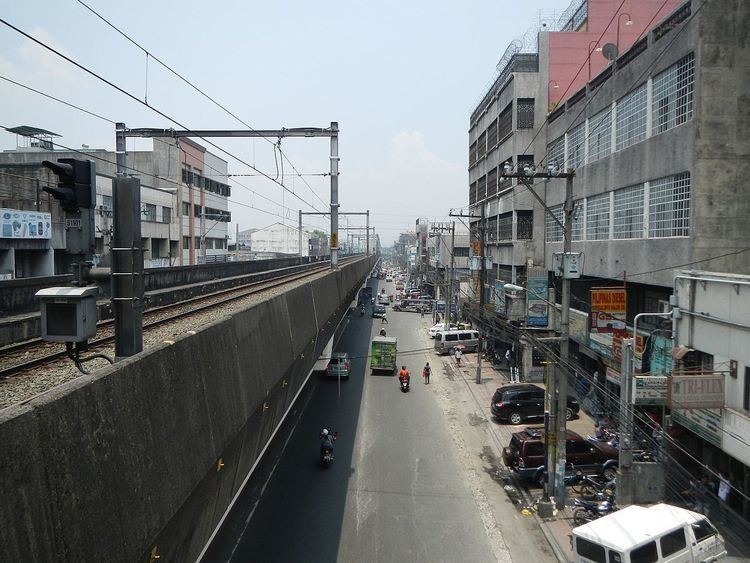
Rizal Avenue
Between the Pasig River front of the district of Santa Cruz and the Monumento Roundabout at the intersection with Epifanio de los Santos Avenue (EDSA) in Caloocan, R-9 is known as Rizal Avenue. It runs underneath the Manila Light Rail Transit System Line 1 (LRT-1) linking Santa Cruz with Grace Park. It is the location of three of Metro Manila's biggest cemeteries, the Manila North Cemetery, La Loma Cemetery and the Manila Chinese Cemetery.
MacArthur Highway
R-9 becomes the MacArthur Highway after crossing the intersection of EDSA and Samson Road at the Monumento Roundabout. It connects South Caloocan with Malabon and Valenzuela running parallel to the North Luzon Expressway (R-8) to the east. The highway crosses into the Central Luzon provinces of Bulacan, Pampanga and Tarlac, and Pangasinan and La Union in the Ilocos Region where it is also known as the Manila North Road. The road terminates at the junction with Kennon Road in Rosario.
Pugo-Rosario Road
Between Aspiras-Palispis Highway (formerly Marcos Highway) and its western terminus at MacArthur Highway in Rosario, La Union, R-9 is known as the Pugo-Rosario Road. It passes the La Union Municipalities Pugo and Rosario.