
Country Netherlands Demonym(s) Raaltenaar, Raalter Website www.raalte.nl Local time Wednesday 4:10 PM | Elevation 5 m (16 ft) Time zone CET (UTC+1) Area 172.3 km² Area code 0572 | |
 | ||
Postcode 8055, 8100–8119, 8140–8144 Weather 12°C, Wind SE at 18 km/h, 36% Humidity Points of interest Sallands Landbouwmuseum de Laarm, Boerderij Strunk, American Motorcycle Museum | ||
Raalte ( pronunciation ) is a municipality and a town in the heart of the region of Salland in the Dutch province of Overijssel.
Contents
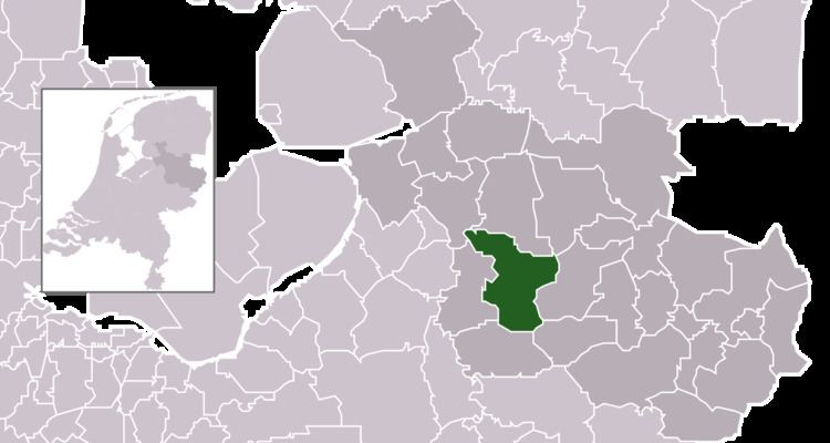
Map of Raalte, Netherlands
Population centres
The municipality consists of the following towns and villages. Raalte is the main place of the municipality, with over 20,000 mostly Roman Catholic inhabitants. It is a regional market, education and shopping centre.
Transport
Railway stations: Heino, Raalte
Raalte and Heino have railway stations along the minor railroad Zwolle - Enschede. Frequency: mostly twice per hour.
An important road for motorists is the N348 Deventer - Wesepe ( mun. Olst-Wijhe - Raalte - Lemelerveld - Ommen ( in northeasterly direction from Deventer). In Raalte it crosses a road (N35) from Zwolle going south-east over Heino, Raalte, Mariënheem and Nijverdal to Wierden, where it continues as a highway (A35) to Almelo and Enschede.
Economy
Raalte has a lot of small industrial enterprises, many of them processing agricultural products. For the local economy, trade, agriculture (especially breeding cattle) and tourism are more important.